
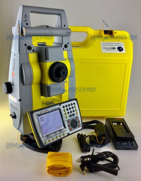
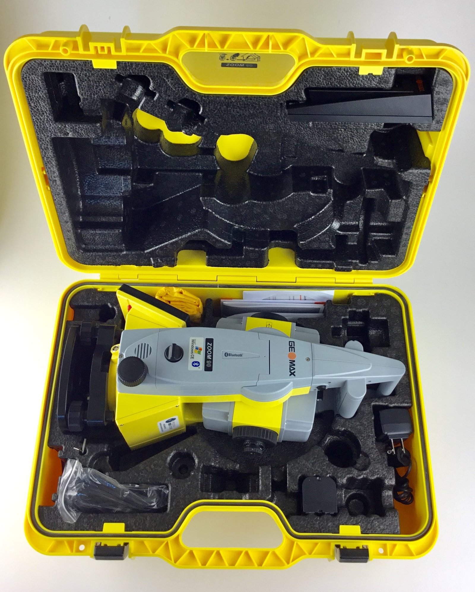
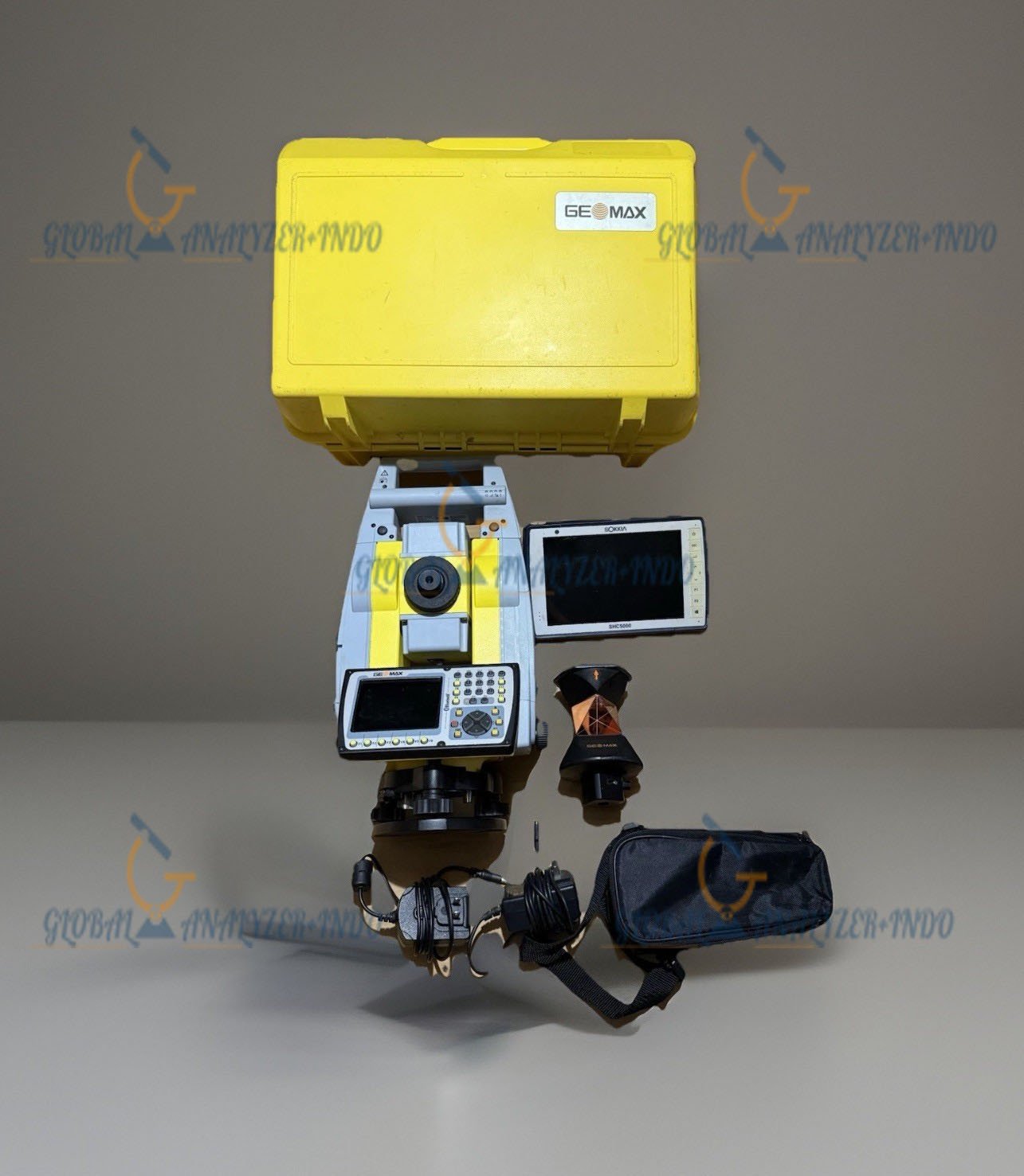
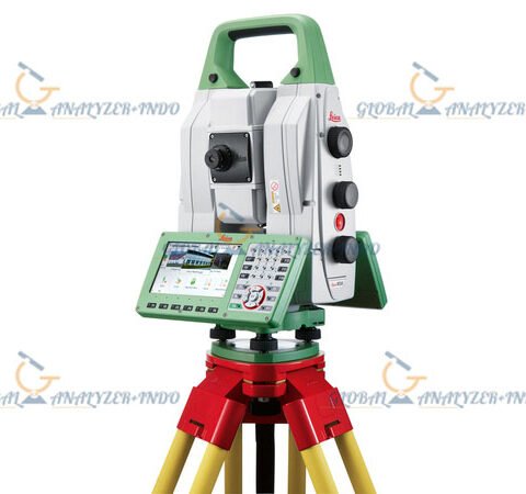
GeoMax Zoom 90 Robotic Total Station: Precision Surveying Solution
The GeoMax Zoom 90 Robotic Total Station provides highly accurate and efficient surveying for construction, engineering, and infrastructure projects. In modern surveying applications, precision, speed, and reliability are essential. Therefore, the Zoom 90 combines advanced technology and robotic automation to enhance measurement efficiency and data accuracy.
Overview of the GeoMax Zoom 90
The Zoom 90 is a robotic total station designed for fast and reliable surveying tasks. It integrates advanced EDM (Electronic Distance Measurement), precise angle measurement, and robotic automation to support professional surveyors.
Who Uses the GeoMax Zoom 90?
This total station is widely used by:
Surveying and civil engineering teams
Construction project managers
Infrastructure and road design specialists
Land development and geospatial professionals
As a result, it supports a variety of applications requiring precision and mobility.
Key Features of GeoMax Zoom 90
Robotic Automation
The Zoom 90 features a fully robotic system that allows remote operation. Consequently, a single operator can efficiently perform complex measurements without manual prism tracking.
High-Precision EDM Measurement
With long-range and highly accurate distance measurement, the Zoom 90 ensures reliable results. Moreover, it minimizes errors in large-scale surveying projects.
Advanced Angle Measurement
The total station delivers precise horizontal and vertical angle measurements. Therefore, it supports topographic mapping, layout, and engineering tasks with confidence.
Technical Capabilities
Integrated GNSS and GIS Support
The Zoom 90 integrates seamlessly with GNSS and GIS systems. This integration allows surveyors to combine total station data with geographic coordinates for complete project documentation.
Efficient Data Management
The total station supports modern data formats and connects with field software for real-time data processing. Consequently, teams can analyze results immediately and reduce project delays.
Durable and Reliable Design
Built to withstand challenging field conditions, the Zoom 90 performs reliably in harsh environments, including extreme temperatures, dust, and vibrations.
Benefits of Using GeoMax Zoom 90
Increased Surveying Efficiency
Robotic automation and fast measurement speed allow teams to complete surveys more quickly. As a result, projects can stay on schedule and reduce labor costs.
Enhanced Accuracy and Reliability
High-precision EDM and angle measurements ensure repeatable and trustworthy results. Therefore, surveyors can make informed decisions based on accurate data.
Versatile Applications
The Zoom 90 adapts to a wide range of surveying tasks, including construction layout, topography, and land development projects. Consequently, it supports diverse professional needs.
Common Applications
Construction and Infrastructure Layout
Surveyors use the Zoom 90 to layout roads, bridges, and building foundations with high precision.
Topographic and Land Surveys
The system captures accurate topographic data for mapping, planning, and engineering projects.
Geospatial and Mapping Projects
With integration to GIS systems, the Zoom 90 allows surveyors to produce reliable geospatial data for analysis and documentation.
Why Choose GeoMax Zoom 90?
The GeoMax Zoom 90 combines accuracy, speed, and robotic automation in one total station. Professionals choose it when reliability, efficiency, and precise surveying matter.
Trusted GeoMax Technology
GeoMax is a recognized provider of professional surveying instruments. Their technology ensures robust performance and dependable support.
Designed for Field Challenges
The Zoom 90 performs consistently in demanding field conditions. Consequently, it is ideal for surveyors working in both urban and remote environments.


There are no reviews yet.