
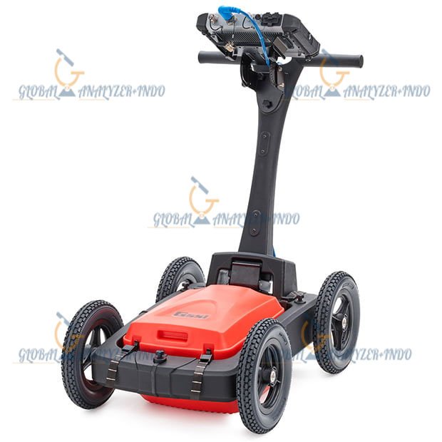


GSSI UtilityScan Pro GPR
The GSSI UtilityScan Pro GPR is a high-performance ground-penetrating radar system designed for precise detection and mapping of underground utilities. It serves engineers, contractors, and survey professionals who require reliable subsurface information to support construction, excavation, and maintenance projects. With advanced radar technology and real-time data visualization, the UtilityScan Pro ensures safe and efficient site operations.
Overview of GSSI UtilityScan Pro GPR
The GSSI UtilityScan Pro integrates robust hardware with intuitive software to provide comprehensive subsurface imaging. It enables users to locate and map utilities, including pipes, cables, and other buried infrastructure, without excavation. The system is designed for both small-scale projects and large construction sites, supporting accurate and efficient utility detection across various soil conditions.
Purpose and Capabilities
The primary purpose of the UtilityScan Pro is to provide detailed insight into subsurface conditions before excavation or construction work. It allows professionals to identify potential conflicts, verify utility layouts, and prevent accidental damage to critical infrastructure, reducing project delays and enhancing safety.
Radar Technology and Performance
The UtilityScan Pro employs advanced ground-penetrating radar technology optimized for utility detection. Its design provides high-resolution imaging and accurate depth estimation, even in challenging soil or urban environments.
High-Resolution Utility Mapping
The system generates precise images of underground utilities, showing both the location and depth of pipes, conduits, and cables. This high-resolution mapping enables informed planning and reduces the risk of accidental utility strikes during construction.
Real-Time Data Analysis
With integrated real-time data visualization, the UtilityScan Pro allows operators to interpret results immediately on-site. The system’s intuitive interface supports quick decision-making and minimizes the need for repeated scans or data post-processing.
Applications of GSSI UtilityScan Pro GPR
The UtilityScan Pro supports a wide range of applications in utility detection, construction planning, and infrastructure maintenance. Its versatility makes it suitable for municipal, commercial, and industrial projects.
Utility Location and Verification
Professionals use the GSSI UtilityScan Pro to locate underground pipes, electrical conduits, and fiber optic cables. Accurate detection ensures that excavation and construction activities can proceed safely and without unnecessary delays.
Site Assessment and Risk Reduction
The system assists in evaluating potential subsurface hazards and verifying existing utility layouts. By providing detailed subsurface information, it supports risk management and reduces the likelihood of costly damages or service disruptions.
System Design and Usability
The GSSI UtilityScan Pro is designed for field efficiency and practical operation. Its portable and ergonomic design allows operators to scan large areas quickly while maintaining accuracy and consistency.
Field-Ready and User-Friendly
The system is equipped with a user-friendly interface that simplifies data acquisition and interpretation. Its lightweight and durable construction ensures reliable performance across diverse site conditions.
Benefits of Using GSSI UtilityScan Pro GPR
The GSSI UtilityScan Pro enhances construction safety, efficiency, and planning accuracy. It minimizes the risk of damaging buried utilities, reduces project downtime, and provides high-resolution subsurface imaging for informed decision-making. Reliable data enables professionals to optimize workflow and maintain compliance with safety standards.
Specifications :
MAX DEPTH
0-12 m (0-40 ft)
ANTENNA OPTIONS
400 MHz, 300/800 DF, 350 HS
WEIGHT
27.2-34 kg (60-75 lbs)
(cart dependent)
STORAGE CAPACITY
32 GB
OPTIONAL SOFTWARE
RADAN 7 for UtilityScan, RADAN 7
ACCESSORIES
LineTrac, Juniper Geode GPS, Tripod for 3-wheel survey cart
The UtilityScan Pro is typically used for:
Underground utility detection
Environmental remediation
Damage prevention
Geological investigation
Archaeology
Forensics
Road inspection
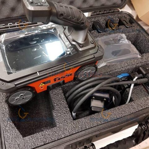
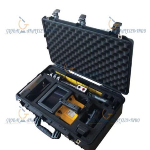
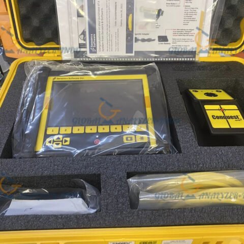
SYSTEM INCLUDES :
SIR 4000 Control Unit
400 MHz, 300/800 DF, or 350 HS Antenna
Choice of 3-wheel or 4-wheel cart
2 m control cable
SIR 4000 sunshade
SIR 4000 AC/DC power supply
Lithium-ion battery (2)
Dual-bay battery charger
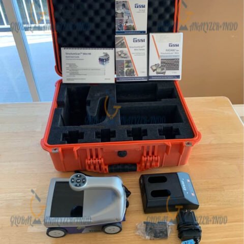
Transit case
2-year warranty
Why Choose GSSI UtilityScan Pro for Utility Detection
The GSSI UtilityScan Pro GPR combines advanced radar technology, intuitive software, and robust design to deliver precise and efficient underground utility mapping. It is a trusted solution for construction, excavation, and infrastructure maintenance professionals who require reliable subsurface information to prevent costly mistakes and ensure safe project execution.

There are no reviews yet.