
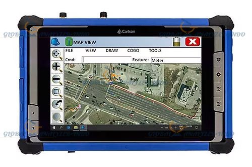
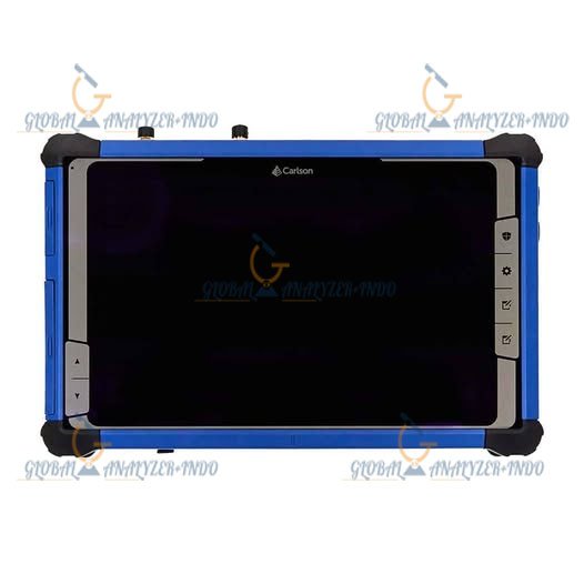
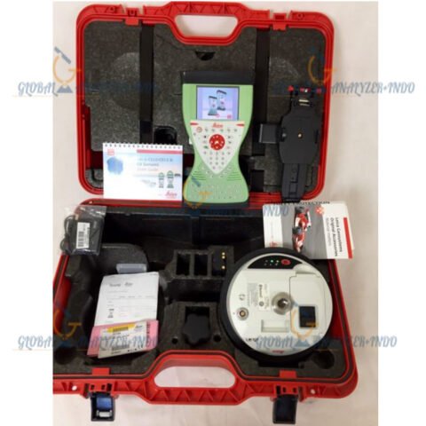
Carlson RT5 Data Collector
The Carlson RT5 Data Collector is a versatile field device designed for surveying, GIS, construction, and mapping professionals. Combining rugged hardware with intuitive software, the RT5 ensures accurate data collection and efficient workflow management in demanding field conditions.
What Is the Carlson RT5 Data Collector?
The Carlson RT5 is a high-performance data collector used by surveyors and engineers to capture, store, and manage field data. Unlike traditional manual methods, the RT5 integrates GNSS receivers, Bluetooth connectivity, and robust software, allowing professionals to collect precise spatial data quickly and efficiently.
Key Technology Overview
The RT5 Data Collector supports GNSS integration, wireless connectivity, and Carlson’s field software applications. Consequently, users can perform accurate measurements, update GIS datasets, and coordinate surveying operations in real time. Moreover, its rugged design ensures reliability in harsh outdoor environments.
Key Features of the Carlson RT5 Data Collector
Rugged and Durable Design
The RT5 is built to withstand extreme temperatures, dust, and water. Therefore, it is ideal for fieldwork in challenging conditions.
High-Performance Data Collection
Equipped with fast processors and large memory capacity, the RT5 ensures smooth operation of field software and rapid data storage. As a result, users can manage large datasets efficiently.
Multi-Connectivity Options
The device supports GNSS receivers, Bluetooth, Wi-Fi, and USB connections. Consequently, it allows seamless data transfer and real-time collaboration.
User-Friendly Interface
Featuring a large touchscreen and intuitive operating system, the RT5 simplifies field data management. Moreover, even professionals new to data collectors can navigate functions quickly.
Benefits of Using the Carlson RT5 Data Collector
Increased Field Efficiency
By integrating GNSS receivers and software, surveyors can collect and process data faster. Therefore, project timelines are shortened without sacrificing accuracy.
Reliable and Accurate Data
Precise GNSS support ensures dependable spatial measurements. As a result, errors are minimized, and project quality improves.
Flexible and Cost-Effective Solution
Although advanced, the RT5’s versatility allows it to be used across surveying, GIS, and construction projects. Consequently, it delivers high long-term value for professionals.
Applications of the Carlson RT5 Data Collector
Land Surveying
The RT5 is widely used for topographic surveys, boundary surveys, and control point measurements. Therefore, it supports accurate and repeatable surveying tasks.
Construction and Engineering
In construction, the RT5 assists with layout, site verification, and project documentation. As a result, construction teams can improve efficiency and reduce errors.
GIS and Mapping
The data collector enables efficient GIS data capture and updating, improving mapping accuracy and decision-making for urban planning, utilities, and environmental management.
Infrastructure Development
Furthermore, the RT5 supports precise measurements for roads, bridges, and other infrastructure projects, ensuring accurate planning and execution.
Why Choose the Carlson RT5 Data Collector?
Trusted Carlson Technology
Carlson is a leading provider of surveying and geospatial solutions. Therefore, the RT5 benefits from proven engineering and reliability.
Balanced Performance and Ease of Use
By combining rugged hardware with intuitive software, the RT5 meets the needs of both experienced surveyors and field teams with minimal training.

There are no reviews yet.