
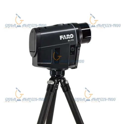
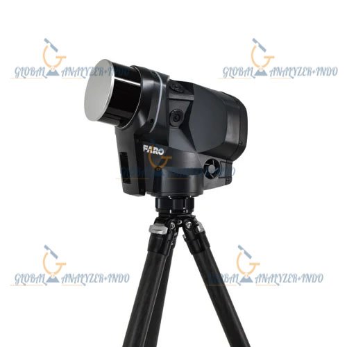
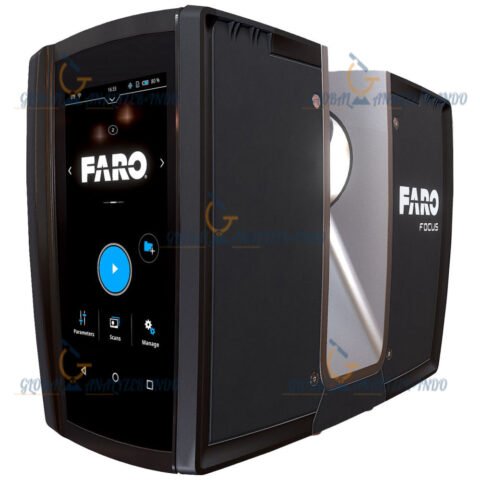
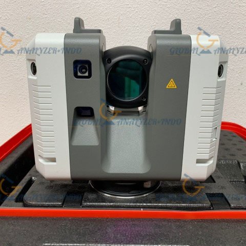
FARO Blink Imaging Laser Scanner
The FARO Blink Imaging Laser Scanner is a modern three-dimensional scanning solution designed to simplify spatial data capture for a wide range of professional applications. It provides fast and accurate imaging that supports digital documentation, measurement, and visualization of physical environments. With its compact design and intelligent scanning capabilities, FARO Blink helps professionals capture reliable spatial data efficiently.
Overview of the FARO Blink Imaging Laser Scanner
The FARO Blink Imaging Laser Scanner is developed to make reality capture more accessible and practical for daily workflows. It enables users to generate detailed three-dimensional representations of indoor and outdoor spaces without complex setup procedures. This scanner supports consistent data capture while maintaining ease of use, making it suitable for both technical specialists and general users.
Purpose and Core Functionality
The primary purpose of the FARO Blink Imaging Laser Scanner is to capture accurate spatial information that supports digital documentation and analysis. It allows users to record existing conditions, create visual records, and support planning or verification tasks across multiple industries.
Imaging Technology and Scanning Performance
The FARO Blink Imaging Laser Scanner uses advanced laser imaging technology to capture precise spatial data. Its scanning system balances accuracy and speed, allowing users to document environments efficiently while maintaining reliable measurement quality.
High-Quality 3D Imaging
The scanner produces clear three-dimensional images that accurately represent surfaces, geometry, and spatial relationships. This imaging capability supports detailed visualization and helps users interpret complex spaces with confidence.
Efficient Data Capture Workflow
The system enables rapid scanning with minimal preparation time. Users can complete scans quickly, which helps reduce time on site and improves overall project efficiency.
Applications of the FARO Blink Imaging Laser Scanner
The FARO Blink Imaging Laser Scanner supports a wide range of professional applications where accurate spatial data plays a critical role. Its versatility allows it to adapt to different working environments and project requirements.
Building Documentation and Facility Management
Professionals use the FARO Blink to document existing building conditions and support facility management tasks. Accurate digital records help improve maintenance planning, space utilization, and asset tracking.
Construction and Renovation Planning
The scanner assists construction teams and planners by providing reliable three-dimensional data for design verification and renovation preparation. Access to accurate spatial information helps reduce errors and improve coordination.
Virtual Visualization and Digital Twin Creation
The FARO Blink Imaging Laser Scanner supports virtual visualization by enabling the creation of digital representations of physical spaces. These digital models help stakeholders review and understand environments remotely.
Design and Ease of Use
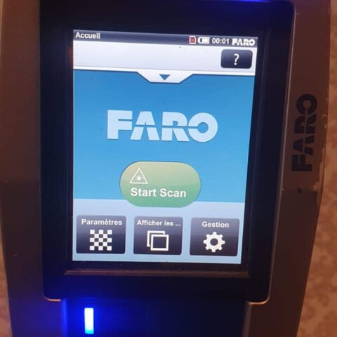
The FARO Blink Imaging Laser Scanner features a compact and user-friendly design that supports easy transportation and operation. Its intuitive interface allows users to focus on capturing data rather than managing complex scanning settings.
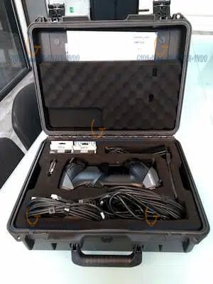
Portable and Practical Form Factor
The lightweight design of the FARO Blink makes it suitable for frequent movement between sites. Users can deploy the scanner quickly in different environments without compromising performance.
Benefits of Using FARO Blink Imaging Laser Scanner
The FARO Blink Imaging Laser Scanner helps professionals capture spatial data quickly while maintaining accuracy. It reduces manual measurement efforts and supports efficient digital workflows. By providing reliable imaging results, the scanner contributes to improved planning, documentation, and communication.
PERFORMANCE
Data Acquisition
HDR color scans in less than 30 s per position
3D Point Accuracy Fully Automatic Leveling
4 mm @ 10 m (0.16 in @ 32.8 ft) 0.3 mm over 1 m (0.012 in over 3.28 ft)
IMAGING
Panoramic Camera System
Dual on-axis HDR camera system with 25 MPx resolution Provides 125 MPx raw image resolution
SCANNING
Laser Class
Laser Class 1
Field of View
300° vertical / 360° horizontal
Range
0.5 m – 80 m (1.64 ft – 262.5 ft)
3D Points Per Scan
Up to 50 MPts
OPERATION
Stand-Alone Operation
One-button scan operation
Real Time Position Tracking
Always know where to capture the next scan
Mobile Devices
FARO Stream App for iOS and Android
Guides the user through a successful on-site workflow and provides direct sync to cloud processing with FARO Sphere XG
DATA PROCESSING
Internal Memory
Up to 1,500 scan positions
Data Transfer
WiFi (2.4 GHz and 5 GHz) USB-C to store data on a thumb drive (high speed thumb drive included)
Desktop Software
FARO SCENE for advanced processing and registration needs
Cloud Software
Fully automated with FARO Sphere XG
POWER
Power Supply
14.4 V (internal battery)
Capacity
Typical Battery Operation Time: About 3 hours 3 batteries included for a full day of data capture
Battery Charge Time
< 3h
PHYSICAL
Dimensions
280 mm x 115 mm x 225 mm (11 in x 4.5 in x 8.9 in)
Weight
3.7 kg (8.2 lbs, including battery)
ENVIRONMENTAL
Operating Temperature
+5°C to +40°C (41°F to 104°F)
Storage Temperature
-10°C to +60°C (14°F to 140°F)
Dust / Humidity
IP 54 / non-condensing
Why Choose FARO Blink for Imaging Laser Scanning
The FARO Blink Imaging Laser Scanner combines ease of use, reliable performance, and versatile application support in a compact solution. It serves as a practical choice for professionals who require accurate three-dimensional imaging to support documentation, planning, and visualization tasks. Its balanced design makes it well suited for modern digital capture workflows.


There are no reviews yet.