
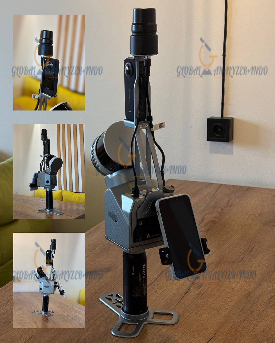
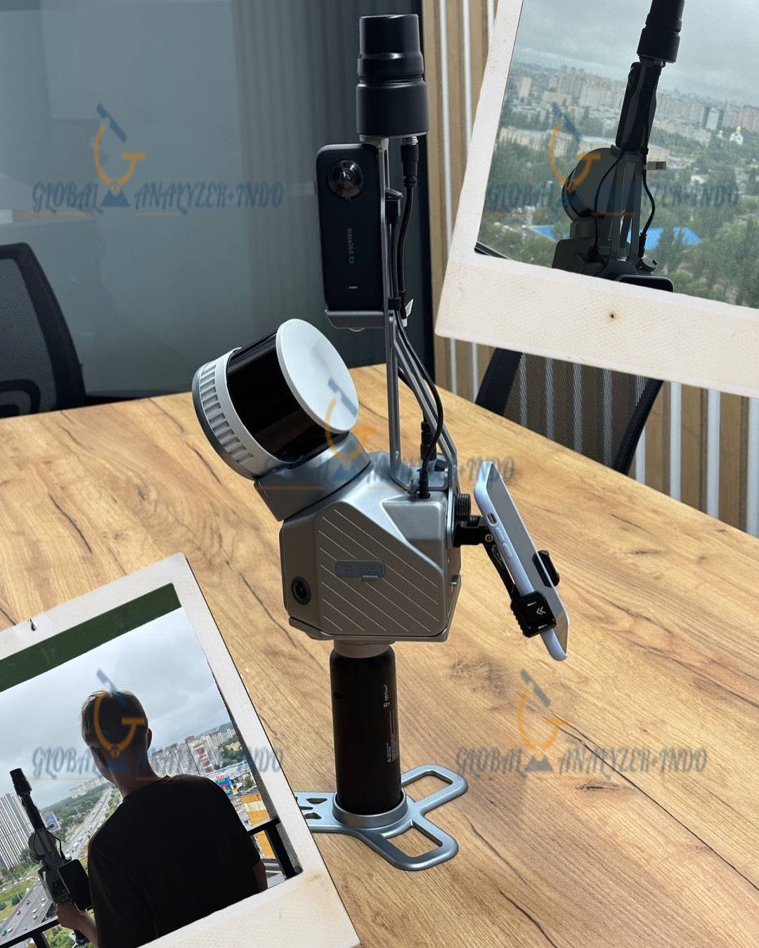
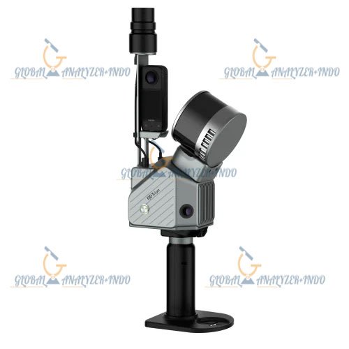
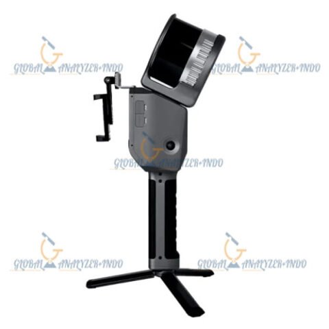
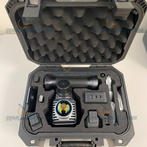
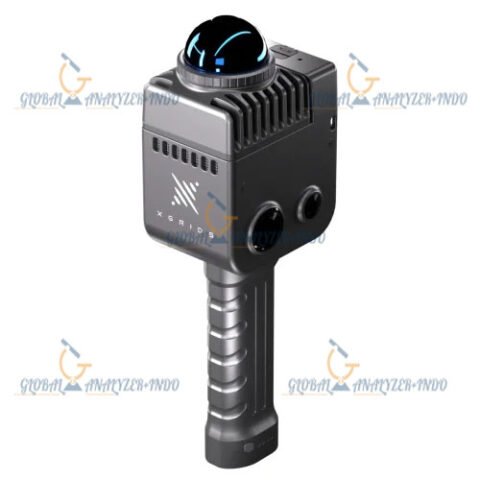
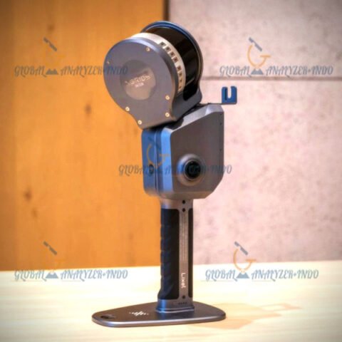
FJD Trion S2 Max LiDAR Scanner
The FJD Trion S2 Max LiDAR Scanner is a high-performance mobile mapping solution designed to capture accurate three-dimensional spatial data in complex environments. It supports professionals in surveying, construction, engineering, and asset management who require precise and efficient data collection. By combining advanced LiDAR technology with an integrated positioning system, the Trion S2 Max enables reliable point cloud generation for a wide range of applications.
Overview of FJD Trion S2 Max LiDAR Scanner
The FJD Trion S2 Max is developed as an advanced LiDAR scanning system capable of delivering high-density spatial data with consistent accuracy. It integrates laser scanning, inertial measurement, and positioning technologies into a compact and field-ready solution. This design allows users to perform rapid data capture while maintaining reliable results in indoor and outdoor environments.
Purpose and Data Capture Capabilities
The primary purpose of the Trion S2 Max is to provide detailed three-dimensional mapping of environments and objects. It supports accurate documentation of terrain, buildings, and infrastructure, enabling professionals to create reliable digital representations for analysis, planning, and monitoring.
LiDAR Technology and System Performance
The FJD Trion S2 Max utilizes advanced LiDAR technology optimized for mobile scanning applications. Its system architecture ensures stable data acquisition and high-quality point cloud output, even in challenging conditions.
High-Density Point Cloud Generation
The scanner produces dense point clouds that capture fine details of surfaces and structures. This level of detail supports precise measurements, feature extraction, and accurate modeling for professional workflows.
Integrated Positioning and Motion Compensation
The Trion S2 Max incorporates integrated positioning and motion compensation to maintain data accuracy during movement. This capability allows efficient scanning across large areas while preserving spatial consistency in the collected data.
Applications of FJD Trion S2 Max LiDAR Scanner
The FJD Trion S2 Max supports a broad range of applications across surveying, construction, and infrastructure management. Its flexible design enables use in diverse environments and project requirements.
Surveying and Mapping
Surveyors use the Trion S2 Max to capture detailed spatial data for topographic mapping and site documentation. The system improves efficiency by reducing the time required for traditional survey methods.
Construction and Asset Documentation
The scanner assists construction professionals in documenting existing conditions and monitoring project progress. Accurate LiDAR data supports informed decision-making and effective communication among stakeholders.
System Design and Usability
The FJD Trion S2 Max is designed for efficient field operation and practical deployment. Its compact form factor and balanced design support comfortable use during extended scanning sessions.
Field-Ready and User-Oriented Design
The system supports rapid setup and straightforward operation, allowing users to focus on data collection rather than complex configuration. Its durable construction ensures reliable performance in demanding environments.
Benefits of Using FJD Trion S2 Max LiDAR Scanner
The FJD Trion S2 Max enhances data collection efficiency while delivering accurate and reliable three-dimensional information. It reduces the time and effort required for spatial documentation and improves data quality for analysis and modeling. Consistent LiDAR results help professionals manage projects more effectively and support long-term asset management.
Specifications :
Lidar
Range
120 m @ 80% reflectivity
80 m @ 10% reflectivity
Channels
32
Speed
640,000 pts/s
FOV
360° x 270°
Safety Level
Class 1 / 905nm, eye safety
System Parameters
Relative Accuracy
1.2 cm
Absolute Accuracy
3 cm
Weight
1.8kg
Battery Life
3 h
Storage
512 GB (1TB expandable)
Operating Temperature
20℃ – 50℃
Power Consumption
25 W
Dimensions
107 x 118 x 398 mm
Data Export
Wi-Fi, USB Type-C, USB Type-A
Point Cloud Format
.las / .ply / .pts / .e57
Power Supply
10.8 V, 3 A
Camera
Resolution
2 x 12 MP
FOV
200°
Visual SLAM
Support
Image Export
Support
Image Format
JPG
GNSS
Satellite Constellation
BDS: B1I / B2I / B3I / B1C / B2a / B2b
GPS: L1 C/A / L1C / L2P (Y) / L2C / L5
GLONASS: G1 / G2 / G3
Galileo: E1 / E5a / E5b / E6
QZSS: L1C/A / L1C / L2C / L5
RTK Accuracy
H: 8 mm + 1 ppm RMS
V: 15 mm + 1 ppm RMS
PPK
Support
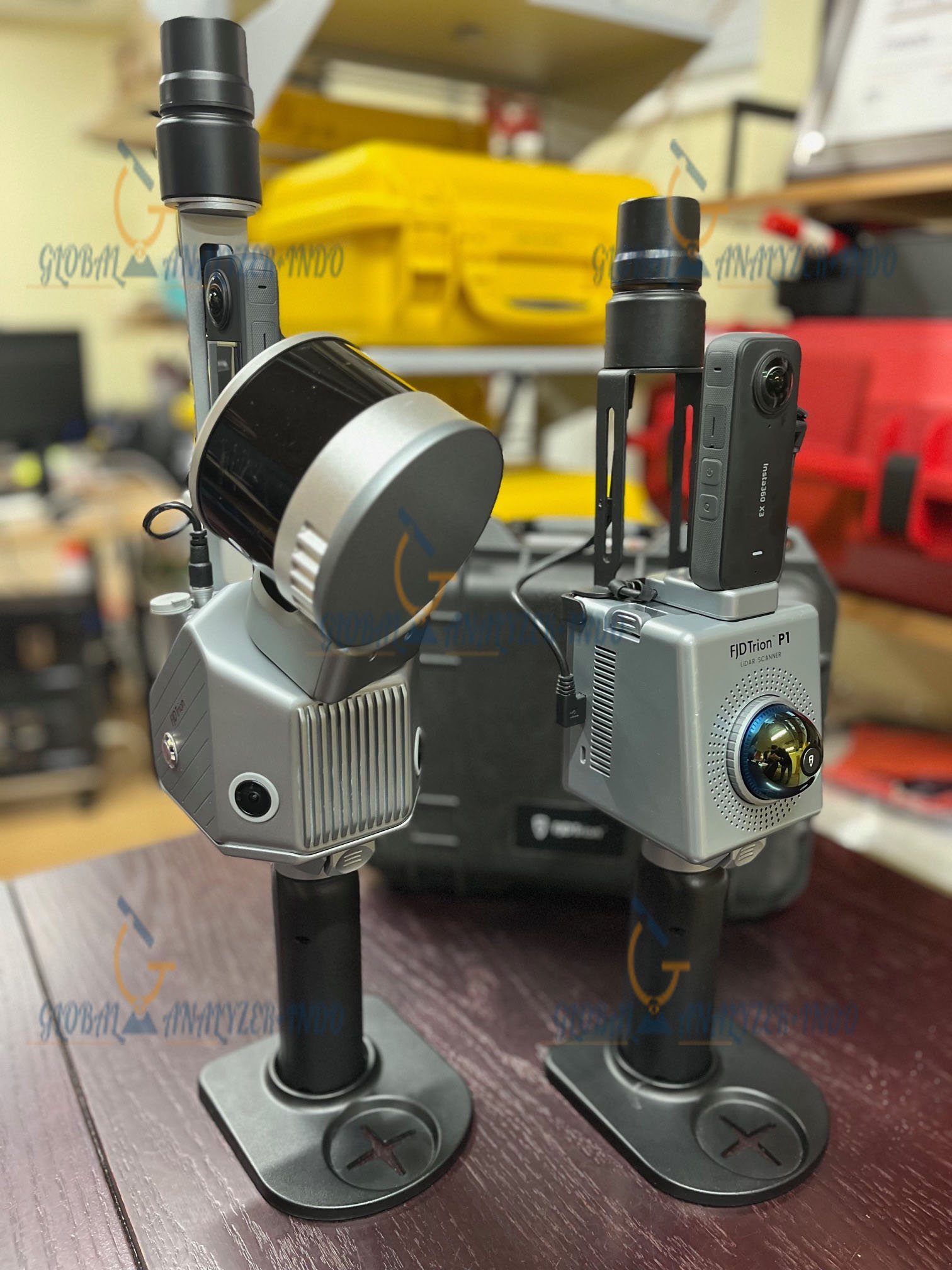
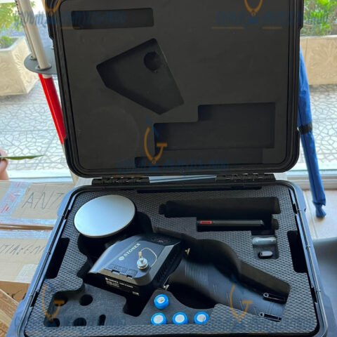
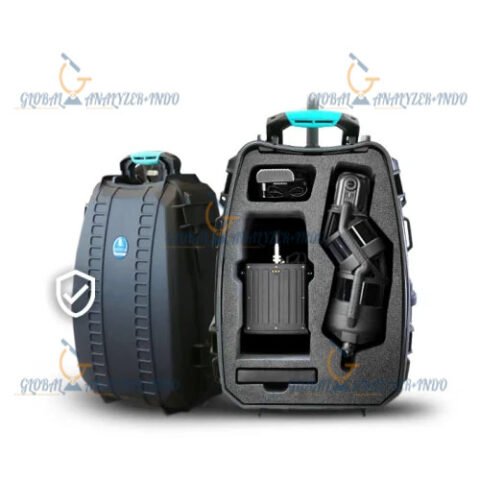
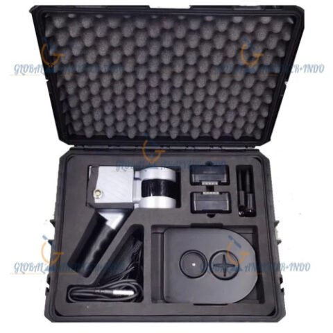
INCLUDED :
Stabilizing vest
Extension pole
Rolling suitcase
TRION Model Basic Permanent License
1x Carry box
2x Batteries
1x Charger
1x Insta360 Camera
Mini RTK Module
Why Choose FJD Trion S2 Max for LiDAR Mapping
The FJD Trion S2 Max LiDAR Scanner combines advanced scanning technology, integrated positioning, and practical usability in a single solution. It is a dependable choice for professionals who require precise spatial data for surveying, construction, and infrastructure applications. By delivering high-quality point clouds and efficient workflows, the Trion S2 Max meets the demands of modern LiDAR mapping projects.
There are no reviews yet.