
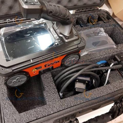
GSSI SIR 4000 GPR Controller for Professional Subsurface Investigation
Introduction to the GSSI SIR 4000 GPR Controller
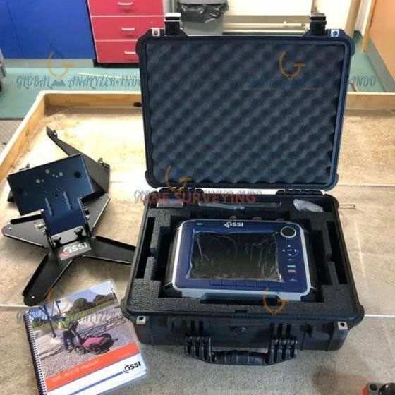
The GSSI SIR 4000 GPR Controller is a powerful and versatile control unit designed to operate ground penetrating radar (GPR) systems for advanced subsurface investigation. As infrastructure, construction, and geophysical projects demand accurate underground data, this controller helps professionals capture, process, and interpret GPR data efficiently.
Moreover, its robust design and flexible configuration make it suitable for a wide range of field applications.
What Is the GSSI SIR 4000?
Understanding the Role of a GPR Controller
A GPR controller manages data acquisition, storage, and system operation for ground penetrating radar antennas. It serves as the central interface that allows users to control scans, adjust settings, and visualize results in real time.
Purpose of the SIR 4000 in GPR Surveys
The SIR 4000 supports detailed subsurface imaging across various environments. Therefore, professionals use it to detect utilities, geological features, and structural elements beneath the surface.
Key Features of the GSSI SIR 4000 GPR Controller
High-Performance Data Acquisition
The SIR 4000 captures high-quality GPR data with precision. As a result, users can analyze subsurface conditions with greater confidence.
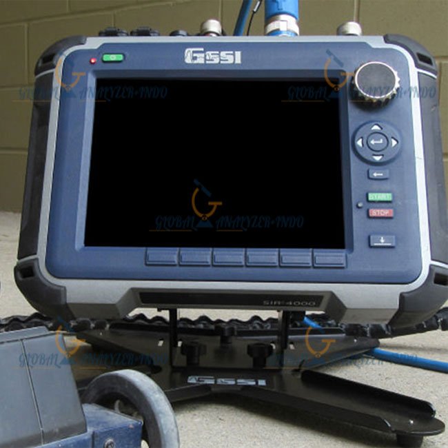
Large Color Display for Real-Time Viewing
The controller features a clear color display that presents scan data in real time. Consequently, operators can monitor data quality and adjust scanning parameters on site.
Flexible Antenna Compatibility
The SIR 4000 supports multiple GPR antennas. This flexibility allows users to adapt the system for shallow or deep surveys, depending on project requirements.
Rugged and Field-Ready Design
Designed for outdoor use, the controller withstands harsh field conditions. Therefore, it performs reliably in construction sites and remote locations.
Applications of the GSSI SIR 4000
Utility Detection and Mapping
Survey teams use the SIR 4000 to locate buried utilities such as pipes and cables. This capability helps reduce the risk of accidental damage during excavation.
Geotechnical and Geological Surveys
The controller supports subsurface analysis for soil profiling and geological studies. As a result, engineers gain valuable insights for foundation and infrastructure planning.
Transportation and Infrastructure Inspection
Professionals apply the SIR 4000 to assess roadways, bridges, and pavements. This inspection helps identify voids and structural anomalies beneath surfaces.
Archaeological and Environmental Studies
Researchers use GPR systems controlled by the SIR 4000 to explore historical sites and environmental conditions without disturbing the ground.
Benefits of Using the GSSI SIR 4000 GPR Controller
Accurate Subsurface Imaging
High-quality data collection improves interpretation accuracy. Therefore, decision-makers can rely on results with greater confidence.
Efficient Field Operations
The intuitive interface simplifies survey setup and execution. As a result, teams complete surveys faster and with fewer errors.
Improved Project Safety
By revealing hidden underground features, the system helps prevent accidents. Moreover, it supports safer excavation and construction practices.
Long-Term Cost Efficiency
Early detection of subsurface issues reduces costly repairs and delays. Consequently, projects remain on schedule and within budget.
Who Should Use the GSSI SIR 4000?
Geophysical and Surveying Professionals
Surveyors benefit from precise data collection across diverse applications.
Civil and Structural Engineers
Engineers use subsurface data to support design and construction decisions.
Utility and Infrastructure Managers
Managers rely on accurate mapping to maintain underground assets and plan maintenance activities.
Why Choose the GSSI SIR 4000 GPR Controller?
The GSSI SIR 4000 GPR Controller combines reliability, flexibility, and performance in one platform. Moreover, its compatibility with various antennas makes it a practical solution for professionals who require dependable subsurface imaging tools.


There are no reviews yet.