
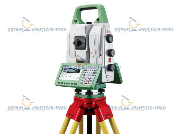
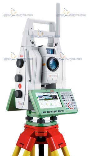
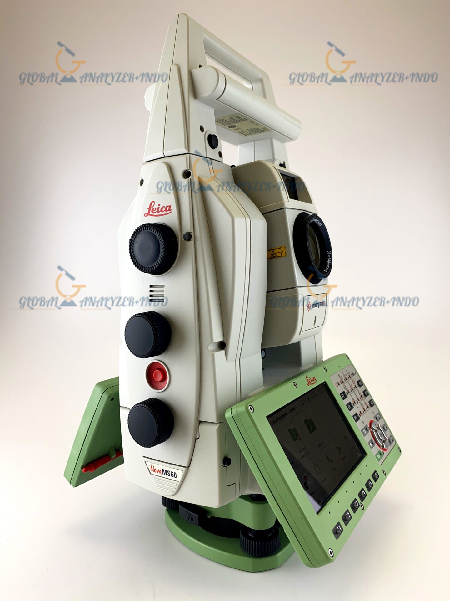
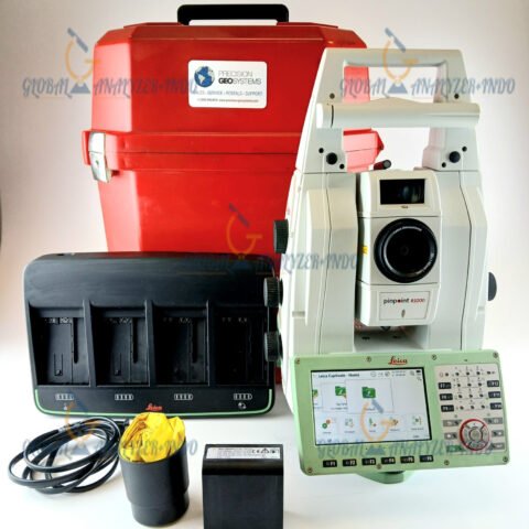
Leica Nova MS60 1″ MultiStation: Ultimate Precision for Surveying and Construction
The Leica Nova MS60 1″ MultiStation sets a new benchmark in surveying technology. Designed for high-precision measurement, advanced data collection, and efficient workflow, this MultiStation empowers surveyors, engineers, and construction professionals to achieve reliable results across a variety of projects.
Overview of Leica Nova MS60 MultiStation
The Leica Nova MS60 combines total station capabilities, high-accuracy GNSS integration, and laser scanning into a single instrument. This all-in-one solution enables users to perform topographic surveys, construction layout, and detailed documentation without switching devices.
How the MultiStation Works
The instrument measures horizontal and vertical angles, distances, and 3D coordinates with high precision. By integrating multiple measurement technologies, it allows operators to capture accurate data efficiently, reducing fieldwork time and potential errors.
Key Features of Leica Nova MS60
High-Precision Measurement
With 1″ angular accuracy, the MS60 delivers consistent results for critical surveying and engineering tasks. As a result, professionals can trust their measurements in complex projects.
Integrated Laser Scanning
The instrument features advanced laser scanning capabilities, enabling the capture of millions of points for detailed 3D modeling. Consequently, surveyors can create digital representations of sites for planning, design, and verification.
GNSS and Multi-Technology Integration
The MS60 combines traditional total station functions with GNSS, allowing surveyors to switch seamlessly between measurement modes. This flexibility ensures optimal performance in diverse field conditions.
Durable and Field-Ready Design
Built to withstand challenging environments, the MS60 features a rugged design that protects sensitive components while maintaining operational reliability. Furthermore, it supports long working hours without compromising performance.
Applications of Leica Nova MS60 MultiStation
Land Surveying and Mapping
Surveyors use the MS60 for topographic surveys, boundary determination, and mapping projects. As a result, they obtain accurate geospatial data for planning and documentation.
Construction Layout and Verification
Construction teams rely on the MS60 for setting out points, verifying alignments, and monitoring progress. Therefore, it ensures projects adhere to design specifications and quality standards.
Infrastructure and Engineering Projects
Engineers apply the MS60 in infrastructure projects such as bridges, roads, and utilities. Moreover, the integrated laser scanning supports as-built documentation and precise measurement of complex structures.
Benefits of Using Leica Nova MS60
Increased Field Productivity
By combining multiple measurement technologies into one device, the MS60 reduces the need for multiple instruments. Consequently, surveyors save time and streamline workflows.
Accurate and Reliable Data
The instrument provides high-precision measurements and consistent results, enabling confident decision-making for engineering and construction projects.
Long-Term Investment
With Leica’s proven technology, rugged design, and advanced features, the MS60 provides long-term value for professionals who demand precision and reliability in the field.
Why Choose Leica Nova MS60 MultiStation?
Innovative Multi-Technology Solution
Leica has engineered the MS60 to integrate total station, GNSS, and laser scanning technologies. Therefore, professionals gain versatility and efficiency in a single instrument.
Trusted Leica Quality
The Leica Nova MS60 reflects decades of expertise in surveying technology. As a result, users benefit from high accuracy, durability, and ease of use in demanding environments.


There are no reviews yet.