

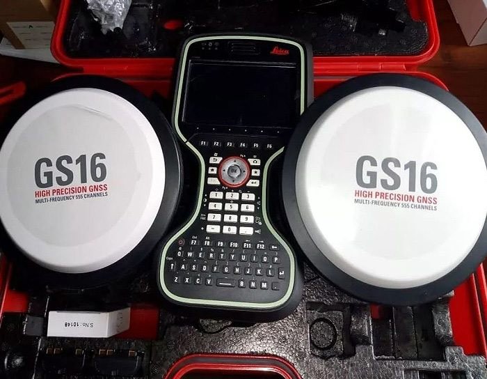
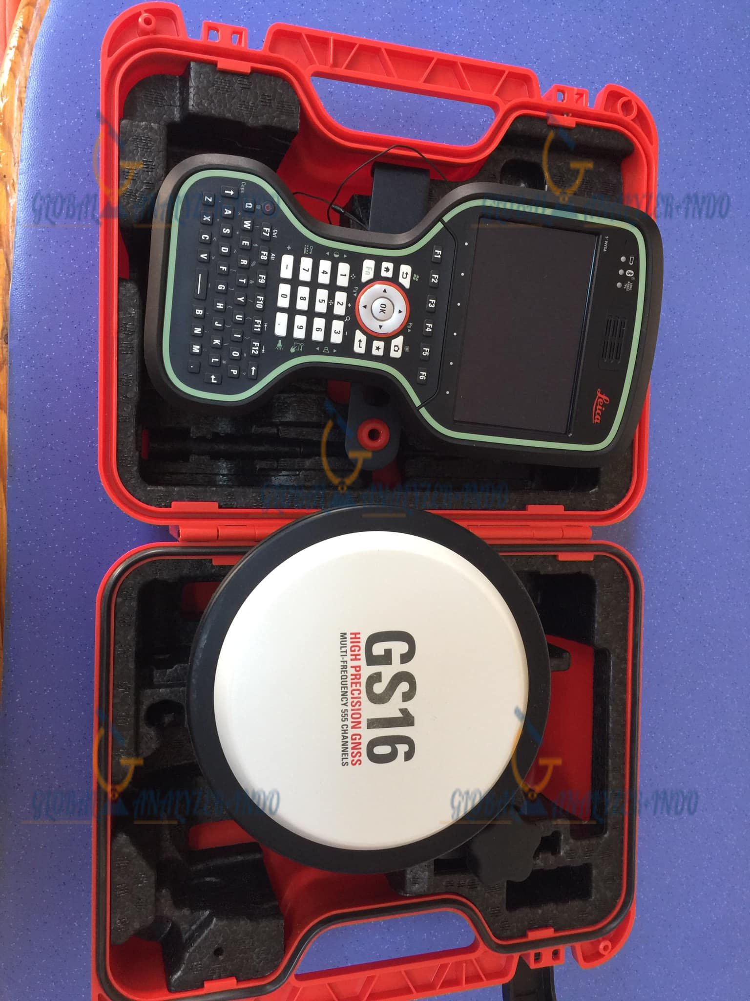
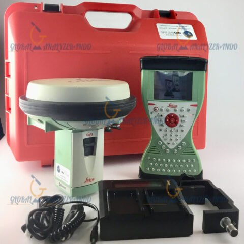
Leica Viva GS16 GNSS RTK: High-Performance Smart Rover for Modern Surveying
The Leica Viva GS16 is a compact, robust, and intelligent GNSS RTK rover designed for professionals who demand high accuracy and exceptional reliability in diverse field environments. Equipped with advanced GNSS technology and smart satellite tracking, the GS16 offers consistent performance even in challenging conditions, making it a trusted solution for land surveying, mapping, construction, and geospatial data collection.
What Is the Leica Viva GS16?
The Viva GS16 is a self-learning GNSS smart antenna that automatically adapts to its surroundings. With Leica’s RTKplus and SmartLink technologies, it ensures strong signal stability and accurate positioning wherever your projects take you—even under canopy, near structures, or in remote areas.
Key Features of the Leica Viva GS16
1. RTKplus Technology for Superior Performance
RTKplus intelligently analyzes satellite signals and optimizes tracking in real time. This enables the GS16 to maintain high-precision positioning accuracy, even when obstructions or interference are present.
2. SmartLink for Reliable Corrections Anywhere
With SmartLink, the GS16 continues to operate smoothly even beyond typical RTK network coverage. The rover automatically switches to satellite-based corrections, ensuring uninterrupted field productivity.
3. Compact, Durable, and Field-Ready
The GS16 is built with a rugged, lightweight design capable of withstanding harsh weather and tough job-site conditions. This makes it ideal for daily professional work, from open fields to dense urban spaces.
4. Fast Initialization and High Precision
Thanks to multi-frequency satellite tracking and advanced processing, the GS16 delivers fast RTK initialization, enabling surveyors to begin work almost immediately with centimeter-level accuracy.
5. Seamless Integration with Leica Captivate
Leica Captivate software transforms complex datasets into intuitive 3D models. When paired with the GS16, users gain an efficient, user-friendly workflow that enhances productivity in the field and office.
Benefits of Using the Leica Viva GS16
High Productivity in All Conditions
The combination of RTKplus and SmartLink helps maintain accuracy even in areas with signal challenges, minimizing downtime and increasing operational efficiency.
Reliable Corrections Without Network Dependency
When cellular networks or base stations are unavailable, satellite-based corrections keep your project moving without interruptions.
Simple and Intuitive Field Operation
The GS16 is designed to be easy to use, even for operators new to GNSS surveying. Automated processes and powerful software integration reduce errors and speed up workflows.
Long-Term Durability
With its robust construction, the GS16 delivers consistent performance over years of use, making it a cost-effective investment for surveying teams.
Typical Applications of the Leica Viva GS16
Land and Topographic Surveying
Capture accurate terrain data quickly and safely across varying landscapes.
Construction Layout and As-Built Documentation
Perform staking, positioning, and quality assurance with high reliability.
GIS Data Collection
Obtain precise geospatial data for mapping, planning, and asset management.
Engineering and Infrastructure Projects
Support roads, utilities, and structural monitoring with precise GNSS measurements.
Why Choose the Leica Viva GS16 GNSS RTK Rover?
The GS16 is a powerful combination of advanced GNSS intelligence, rugged hardware, and flexible correction services. It is built for professionals who require dependable performance across multiple industries and environments. Whether you operate within RTK networks or in remote locations, the GS16 ensures you always get the accuracy and dependability Leica Geosystems is known for.


There are no reviews yet.