
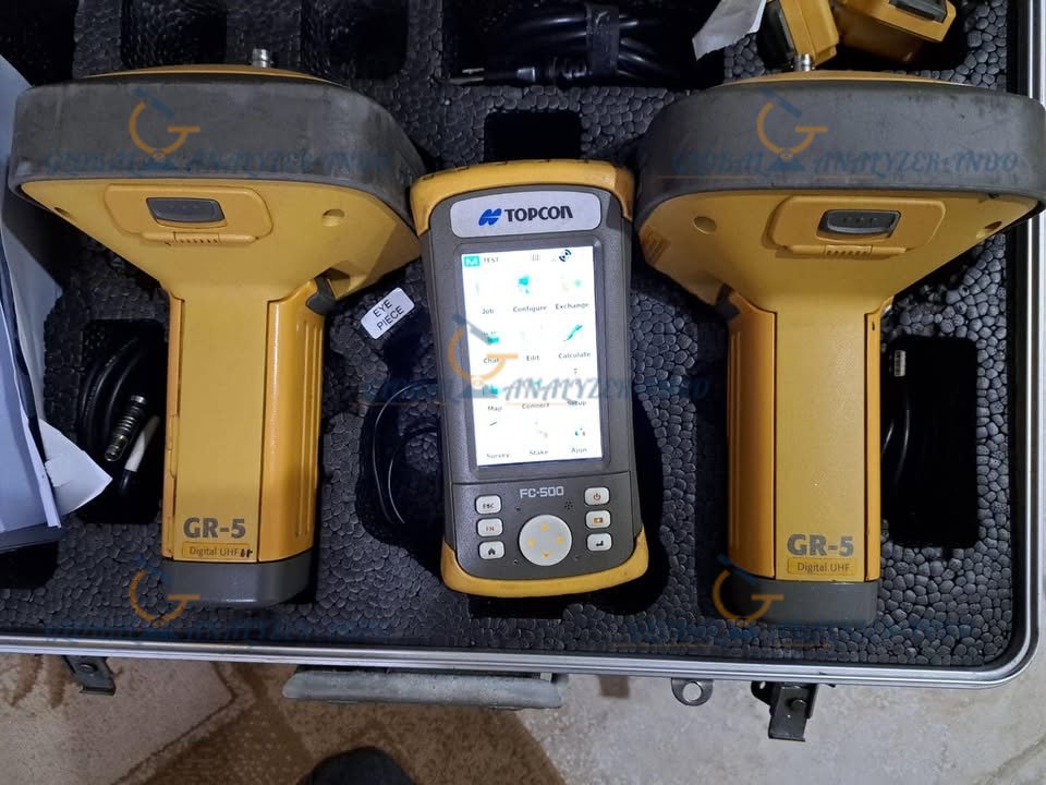
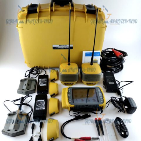
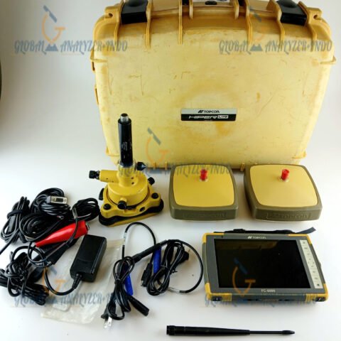
Topcon GR-5 Integrated GNSS Receiver: Reliable Positioning for Professional Surveying
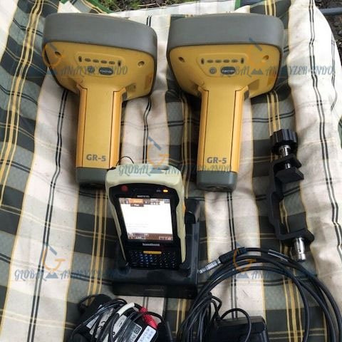
The Topcon GR-5 Integrated GNSS Receiver is a high-performance positioning solution designed for surveying, construction, and geospatial applications. It combines advanced satellite tracking technology with a rugged, compact design, allowing professionals to achieve accurate results in demanding field environments.
What Is the Topcon GR-5 Integrated GNSS Receiver?
The Topcon GR-5 is a multi-constellation GNSS receiver that provides precise positioning data for field operations. It supports modern satellite systems and delivers stable performance in various working conditions. As a result, surveyors and engineers rely on it for accurate and efficient data collection.
Core Functions of Topcon GR-5
High-accuracy GNSS positioning
Data collection for surveying and mapping
Support for construction layout and control
Reliable performance in challenging environments
Key Features of Topcon GR-5
Multi-Constellation GNSS Tracking
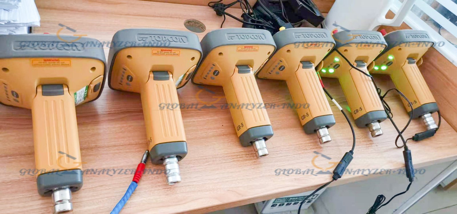
Topcon GR-5 tracks multiple satellite constellations to improve signal availability. Therefore, it delivers reliable positioning even in areas with limited sky visibility.
Integrated Design for Field Efficiency
The receiver integrates GNSS technology, communication modules, and power management in one compact unit. Consequently, it simplifies setup and reduces equipment handling time in the field.
Rugged and Weather-Resistant Housing
Topcon GR-5 features a durable enclosure designed for harsh outdoor conditions. As a result, it performs consistently in construction sites, remote locations, and adverse weather.
Technical Capabilities
High-Precision Positioning Performance
The receiver delivers accurate positioning data suitable for professional surveying tasks. Moreover, it supports both static and dynamic applications, ensuring flexibility across different projects.
Flexible Communication Options
Topcon GR-5 supports various communication methods for data transfer and real-time corrections. Therefore, users can adapt the receiver to different workflow requirements.
Efficient Power Management
The integrated power system supports long operating hours. As a result, field crews can work longer without frequent battery changes.
Applications of Topcon GR-5 Integrated GNSS Receiver
Land Surveying and Mapping
Surveyors use Topcon GR-5 to collect precise spatial data for mapping and boundary determination. Consequently, it improves accuracy and productivity in surveying projects.
Construction and Engineering
The receiver supports construction layout, site control, and machine guidance workflows. Therefore, it helps ensure accurate positioning throughout construction processes.
Infrastructure and Utility Projects
Topcon GR-5 assists in positioning tasks for infrastructure development and utility mapping. Moreover, it supports reliable data collection in complex environments.
Benefits of Using Topcon GR-5
Improved Field Productivity
Fast initialization and stable tracking reduce downtime. As a result, teams can complete field tasks more efficiently.
Consistent and Reliable Results
Multi-constellation support ensures dependable positioning data. Therefore, users can trust the accuracy of their measurements.
Professional-Grade Durability
The rugged design protects the receiver in demanding conditions. Consequently, it offers long-term value for professional use.
Why Choose Topcon GR-5 Integrated GNSS Receiver?
Designed for Professional Users
Topcon GR-5 meets the needs of surveyors, engineers, and construction professionals. Moreover, it integrates seamlessly into modern GNSS workflows.
Proven Performance in the Field
Its combination of accuracy, durability, and flexibility makes it suitable for a wide range of applications. Therefore, it remains a reliable choice for precision positioning.

There are no reviews yet.