
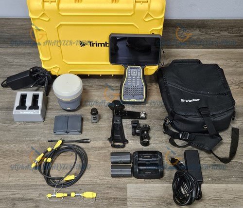
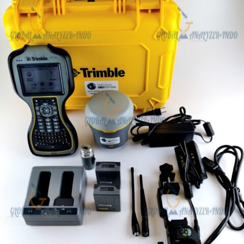
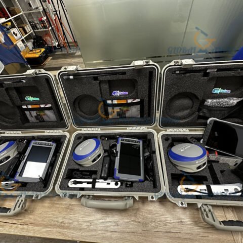
Trimble R12i GNSS Base and Rover with TSC7 Controller Package
The Trimble R12i GNSS Base and Rover combined with the TSC7 controller is one of the most advanced survey solutions available today. Known for speed, accuracy, and intelligent sensor integration, this package is designed to help surveyors work faster and deliver precise results even in the most challenging environments.
What Is the Trimble R12i GNSS System?
The Trimble R12i is a high-performance GNSS receiver that uses advanced signal processing and inertial technology to improve accuracy and productivity. It is engineered for demanding fieldwork where reliability, speed, and precision are essential.
Key Technologies Used in the R12i
-Trimble ProPoint GNSS Engine
Delivers strong performance in areas with weak signals, tree cover, or urban obstacles.
-Trimble TIP™ Tilt Compensation
Eliminates the need to level the pole, improving measurement speed and reducing field errors.
-Enhanced Multi-Constellation Tracking
Supports GPS, GLONASS, Galileo, BeiDou, and other major satellite systems.
Overview of the TSC7 Controller
The Trimble TSC7 is a rugged, tablet-style field controller designed to pair seamlessly with the R12i receiver. It offers a powerful combination of performance and usability for professional survey applications.
TSC7 Key Features
-7-inch sunlight-readable touchscreen
-Full keyboard for fast data entry
-Long-lasting battery for all-day field use
-Runs Trimble Access software for easy data management and workflow automation
Advantages of the Trimble R12i Base and Rover Package
1. Higher Productivity in Challenging Conditions
Thanks to ProPoint technology and advanced interference mitigation, the R12i maintains reliable positioning even under heavy tree canopy or near reflective surfaces.
2. Faster Measurements With Tilt Compensation
With TIP technology, users can measure points without stopping to level the pole, enabling quick data capture on slopes, around obstacles, and in tight locations.
3. Seamless Field Operation With the TSC7
The TSC7 controller boosts workflow efficiency with a large display, powerful processing, and intuitive software tools tailored for surveying tasks.
4. Improved Accuracy for Critical Survey Applications
Precise horizontal and vertical measurements help ensure consistent results for land surveying, construction layout, mapping, and infrastructure work.
Typical Applications of the R12i GNSS Package
Land and Boundary Surveying
The system provides accurate control points and boundary line measurements even in mixed-signal environments.
Construction Layout and Site Positioning
With rapid point capture and real-time corrections, the package fits perfectly for layout tasks on active construction sites.
Topographic and Detail Surveys
The combination of powerful GNSS tracking and tilt compensation helps collect topographic data more efficiently.
GIS and Mapping
High-precision data capture supports asset mapping, environmental studies, and utilities documentation.
Why Choose the Trimble R12i and TSC7 Package?
Durability and Reliability
Both the receiver and controller are built with rugged materials that withstand dust, water, vibration, and extreme temperatures—ideal for long-term field operations.
Comprehensive Workflow Integration
From field data collection to office processing, Trimble provides a smooth ecosystem for managing survey information.
Future-Ready Technology
Multi-constellation support and regular firmware improvements ensure the system stays relevant as satellite technology evolves.


There are no reviews yet.