
Leica Viva GS25 High Precision Receiver: Reliable GNSS for Surveying and Construction
Introduction to the Leica Viva GS25 High Precision Receiver
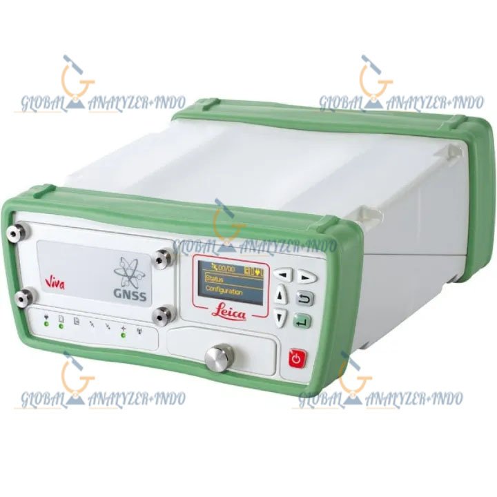
The Leica Viva GS25 High Precision Receiver is a professional GNSS solution designed for precise positioning in surveying, construction, and geospatial applications. As projects demand increasing accuracy, the GS25 ensures fast, reliable, and consistent GNSS data for real-time kinematic (RTK) workflows. Moreover, its rugged design and versatile communication options make it ideal for both field and challenging environments.
Overview of the Leica Viva GS25 Receiver
Designed for High-Precision GNSS Performance
The Leica Viva GS25 offers centimeter-level accuracy for survey and construction tasks. Consequently, surveyors can confidently rely on its performance for mapping, control points, and infrastructure projects. In addition, multi-frequency and multi-constellation GNSS support improve signal reliability and reduce errors in difficult environments.
Robust and Portable Construction
Built for field deployment, the GS25 withstands harsh weather, dust, and rough handling. Therefore, it maintains consistent performance even under demanding conditions. Furthermore, its lightweight and compact design make it easy to carry and operate for extended periods.
Key Features of the Leica Viva GS25 Receiver
Centimeter-Level Accuracy
The Leica Viva GS25 provides high-precision measurements essential for RTK workflows. As a result, surveyors can perform topographic surveys, construction staking, and geospatial mapping with confidence. Additionally, precise positioning improves project quality and reduces rework.
Multi-Constellation and Multi-Frequency Support
Supporting GPS, GLONASS, Galileo, and BeiDou systems, the GS25 ensures reliable signal reception worldwide. Consequently, it can maintain accurate measurements even in areas with partial satellite visibility. Moreover, multi-frequency operation reduces atmospheric errors for improved reliability.
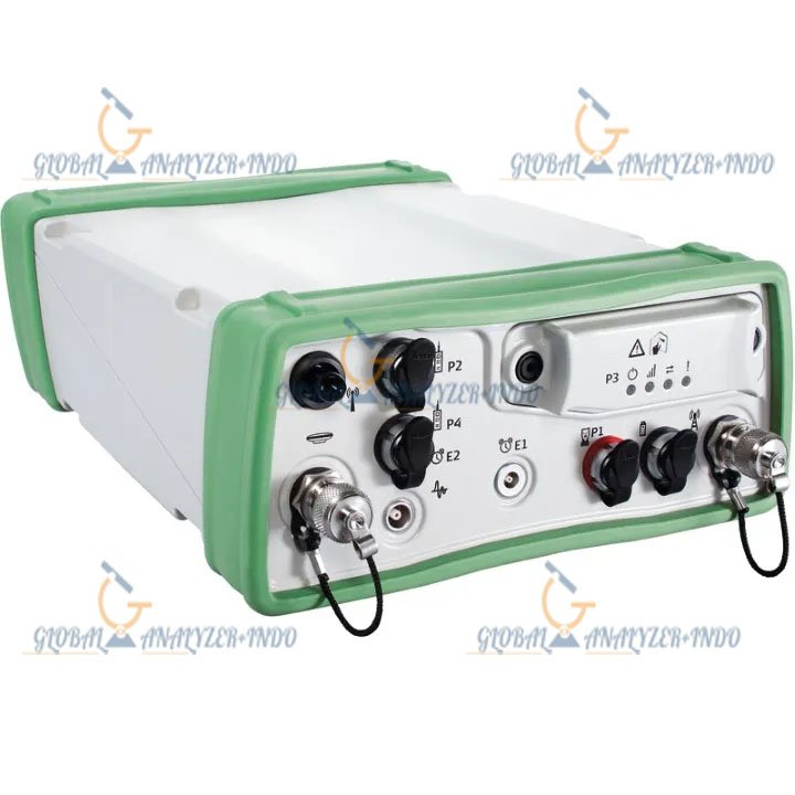
Flexible Communication Options
The device offers multiple radio, Bluetooth, and cellular connectivity options. Therefore, it can integrate seamlessly with base stations, RTK networks, and field controllers. In addition, real-time data transmission ensures uninterrupted workflow for survey and construction teams.
System Integration and Workflow Efficiency
Compatibility with Leica Survey Equipment
The GS25 integrates smoothly with Leica field controllers and software platforms. Consequently, it supports RTK corrections, networked GNSS operations, and post-processing workflows. Moreover, users benefit from intuitive software interfaces that simplify setup and operation.
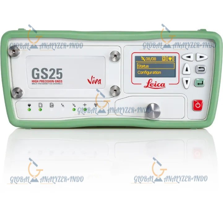
Long Battery Life and Easy Operation
With extended battery capacity and simple interface controls, the GS25 can operate for full workdays without interruption. Therefore, surveyors can complete long-distance or complex site surveys efficiently. In addition, the device provides visual indicators for connection status, battery life, and signal quality.
Applications of the Leica Viva GS25 High Precision Receiver
Land Surveying and Topography
Surveyors use the GS25 to establish accurate control points and map terrain. As a result, data collection is faster and more precise than traditional methods. Moreover, real-time RTK support reduces the need for post-processing, saving time and resources.
Construction and Infrastructure Projects
Construction teams rely on the GS25 for staking, grading, and machine guidance. Consequently, project accuracy is improved, reducing errors and material waste. Additionally, it supports large-scale infrastructure projects by providing consistent GNSS data across extended sites.
Geospatial and Mapping Applications
The GS25 enables geospatial engineers to capture precise spatial data for GIS, urban planning, and environmental monitoring. Therefore, mapping projects benefit from centimeter-level accuracy and reliable real-time positioning. Furthermore, it allows efficient integration into GNSS networks.
Advantages of Using the Leica Viva GS25
Enhanced Accuracy and Reliability
The GS25 ensures precise positioning in diverse environments, including urban areas, forests, and construction sites. Consequently, users can trust the measurements for critical decision-making.
Improved Efficiency in Field Operations
By delivering real-time GNSS corrections and integrating with Leica survey systems, the GS25 reduces workflow time. As a result, field teams can complete projects faster without sacrificing data quality.
GNSS technology
Created from years of experience and knowledge, the Leica GS25 delivers on unrivalled GNSS accuracy and reliability.
Real Time Kinematic data processing with accurate results with Leica SmartCheck
Tracking of all GNSS satellites with Leica SmartTrack
Deliver increased positions in challenging environments with Leica xRTK
Have confidence in the most demanding tasks with the Leica Viva GS25.
Increased Flexibility
The Leica GS25 provides increased flexibility to cover a large array of tasks.
PPS Interface
Event Interface
Simple configuration and status messages with the integrated display
Variety of data storage and communication options


There are no reviews yet.