
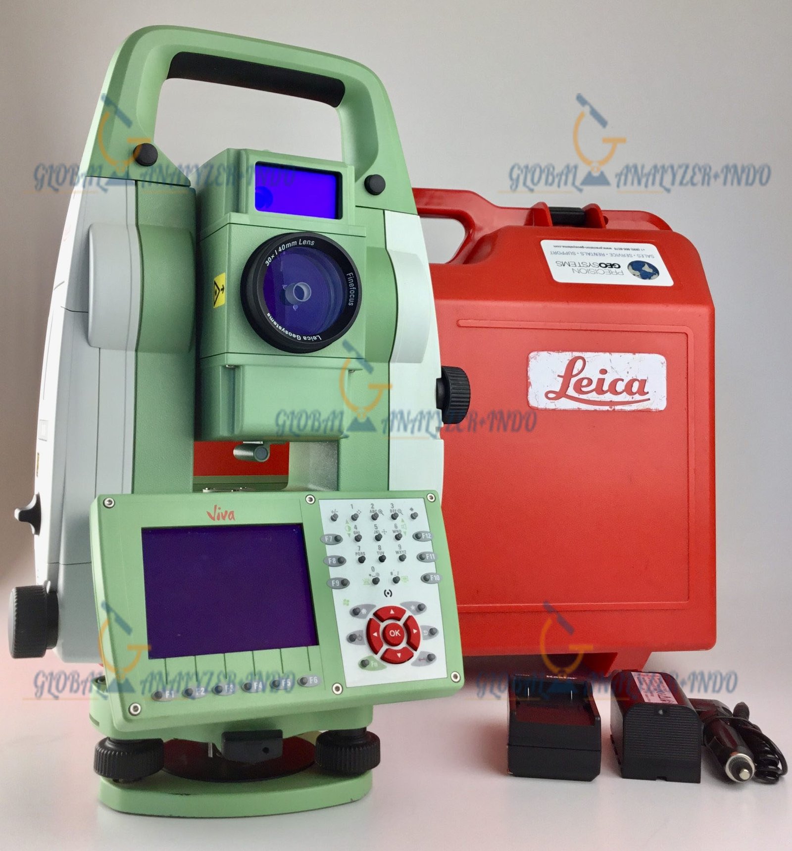
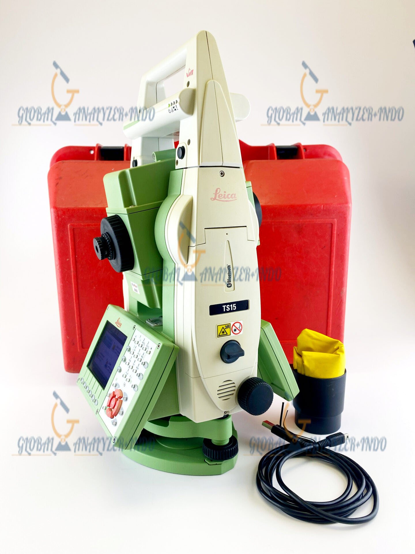
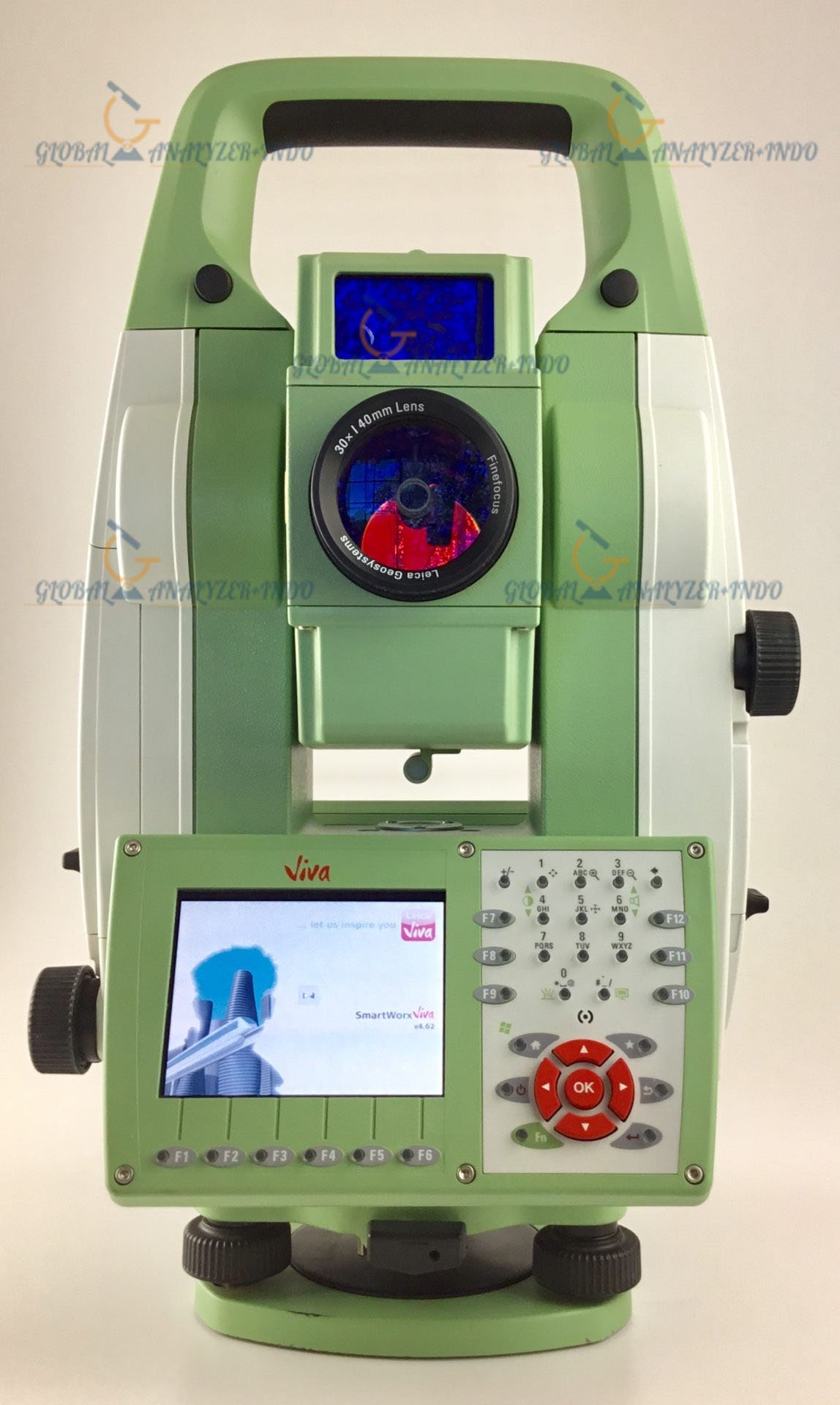
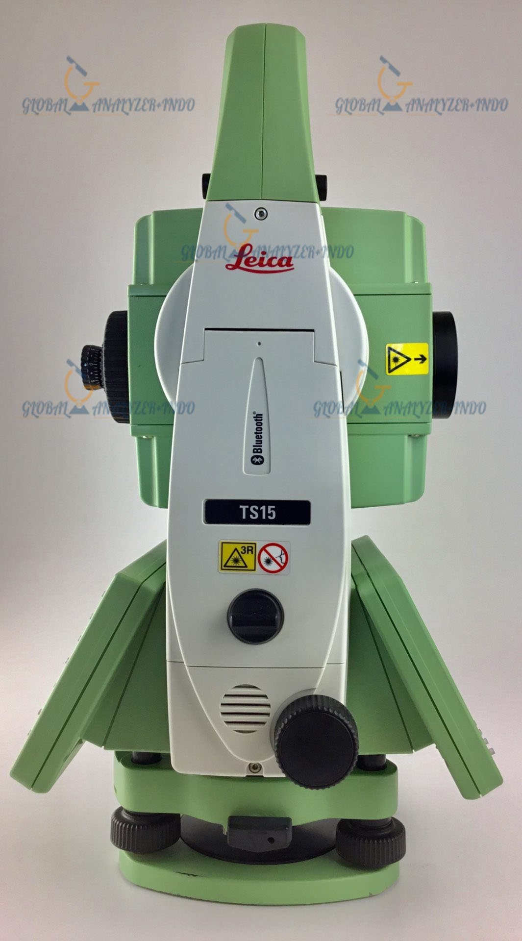
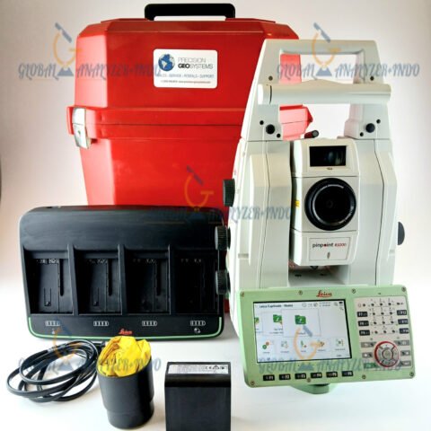
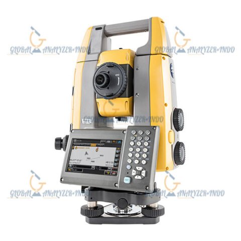
Leica Viva TS15 Imaging Total Station: High-Precision Surveying Made Easy
Introduction to Leica Viva TS15
The Leica Viva TS15 Imaging Total Station is a revolutionary surveying instrument designed for professionals in surveying, construction, and geospatial data collection. Combining advanced robotic functionality with imaging capabilities, the TS15 ensures precise measurements and efficient workflows even in challenging environments.
Why Accuracy Matters in Surveying
In surveying and construction, small errors in measurement can lead to costly delays or design flaws. The TS15 provides reliable centimeter-level accuracy, allowing surveyors and engineers to complete projects confidently and efficiently.
Key Features of Leica Viva TS15
Integrated Imaging Technology
The TS15 features a high-resolution digital camera that assists in capturing precise measurements and documenting sites visually. Its imaging technology enhances data accuracy and supports detailed mapping of the terrain.
Robotic Functionality for Single-Operator Use
Equipped with fully robotic tracking, the TS15 allows a single operator to conduct surveys. The instrument automatically tracks reflective targets, reducing manual effort and improving efficiency on-site.
Ergonomic and Durable Design
Designed to withstand harsh environments, the TS15 is both lightweight and rugged. Its durable construction ensures reliable performance in extreme weather conditions while remaining easy to transport and set up on-site.
Software Integration for Seamless Workflows
The TS15 integrates with Leica Captivate software, enabling real-time 3D data capture and analysis. It supports cloud-based collaboration and simplifies data management for projects involving CAD, GIS, or engineering applications.
Applications of Leica Viva TS15
Land Surveying
The TS15 is ideal for topographic surveys, boundary measurements, and terrain modeling, providing high accuracy and efficiency for professional surveyors.
Construction and Infrastructure Projects
In construction, the TS15 assists with site layout, stakeout, and as-built verification, helping engineers and contractors maintain precision throughout project execution.
Structural Monitoring and Deformation Analysis
The TS15 can monitor structural movement and road deformation, providing essential data for safety evaluations and design assessments.
Benefits of Using Leica Viva TS15
Using the Leica Viva TS15 enhances productivity by automating target tracking and reducing manual workload. It delivers reliable, high-precision measurements that minimize errors. The versatile system is suitable for a wide range of surveying and construction tasks, and its integrated software simplifies data processing and collaboration across teams.
Leica Viva TS15 Compared to Other Total Stations
Compared to other imaging total stations, the TS15 stands out with superior automatic target tracking, higher-resolution imaging, and robustness for harsh field conditions. Its seamless integration with Leica Captivate software ensures faster workflows and better data management for professional projects.
Tips for Maximizing Performance of TS15
To achieve optimal results, ensure proper leveling and calibration of the total station before starting measurements. Utilize the automatic target recognition feature to save time and improve accuracy. Regularly update the firmware and software to access the latest performance enhancements and new features
Best-in-class Imaging
Optimize your productivity with exact photo documentation of site conditions. With live streaming of the total station view, you always know what the total station sees. Measure all points without returning to the total station.
- Image Notes – Capture an image, screenshot or template, sketch on
it and link it to any object in the database - Image Assisted Surveying – Simply tap on the display and the
total station will turn and measure the desired target
Specifications:
| Angular Measurement | |
| Accuracy Hz, V | 1’’ (0.3 mgon), 2’’ (0.6 mgon), 3’’ (1 mgon), 5’’ (1.5 mgon) |
| Display resolution | 0.1’’ (0.1 mgon) |
| Method | absolute, continuous, diametrical |
| Compensation | Quadruple axis compensation |
| Compensator setting accuracy | 0.5’’ (0.2 mgon), 0.5’’ (0.2 mgon), 1.0’’ (0.3 mgon), 1.5’’ (0.5 mgon) |
| Distance Measurement (Prism) | |
| Range | |
| Round prism (GPR1) | 3500 m (12000 ft) |
| 3 Round prisms (GPR1) | 5400 m (17700 ft) |
| 360° prism (GRZ4, GRZ122) | 2000 m (7000 ft) |
| 360° mini prism (GRZ101) | 1000 m (3300 ft) |
| Mini prism (GMP101) | 2000 m (7000 ft) |
| Reflective tape (60 mm x 60 mm) | 250 m (800 ft) |
| Accuracy / Measurement Time |
|
| Standard | 1 mm + 1.5 ppm / typ. 2.4 s |
| Fast | 3 mm + 1.5 ppm / typ. 0.8 s |
| Continuous | 3 mm + 1.5 ppm / typ. <0.15 s |
| Distance Measurement (Any Surface) |
|
| Range | |
| PinPoint R30 / R400 / R1000 | 30 m (98 ft) / 400 m (1310 ft) / 1000 m (3280 ft) |
| Accuracy / Measurement Time | |
| PinPoint R30 / R400 / R1000 | 2 mm + 2 ppm / typ. 3 s |
| Distance Measurement (Long-range) |
|
| Long-range | >10000 m (>32800 ft) |
| Accuracy / Measurement Time |
|
| Long-range | 5 mm + 2 ppm / typ. 2.5 s |
| General | |
| Display resolution | 0.1 mm |
| Shortest measurable distance | 1.5 m |
Warranty Information
2 Years


There are no reviews yet.