
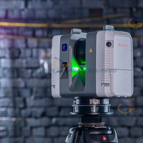
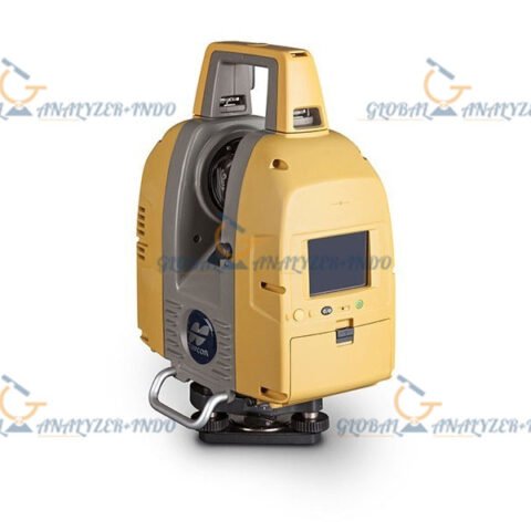
Topcon GLS-2000 3D Laser Scanner: Accurate, Fast, and Reliable Scanning for Any Project
The Topcon GLS-2000 3D laser scanner is a state-of-the-art tool designed to rapidly and accurately capture 3D data at any project site. Whether you are working in construction, topography, civil engineering, or BIM (Building Information Modeling), the GLS-2000 provides industry-leading accuracy and high-speed data capture, making it an invaluable tool for a wide range of applications.
Key Features of the Topcon GLS-2000 Laser Scanner
The Topcon GLS-2000 offers innovative features that set it apart in the laser scanning market. From high-speed 360° dome scanning to dual-camera functionality, this scanner ensures fast, precise, and reliable data capture for various industries.
High Accuracy with Precise Scan Technology
The Topcon GLS-2000 delivers a distance accuracy of 3.5mm from 1m to 150m. Its 6 arc-seconds horizontal and vertical angle accuracy guarantees high-precision results for detailed 3D models. Topcon’s Precise Scan Technology minimizes noise and measurement deviation, ensuring data quality and reliability for all your projects.
High-Speed 360° Dome Scanning
Capture a full 360° scan of your project site in less than 3 minutes, including images. This fast scanning capability helps save valuable time, making the GLS-2000 perfect for large-scale environments such as construction sites and building inspections. Its high-speed scanning is a key advantage for BIM workflows, where efficiency and accuracy are paramount.
Dual Camera System for Enhanced Imaging
The GLS-2000 is equipped with dual internal digital cameras that provide high-definition images at every scan level. These cameras ensure that the point clouds captured are paired with the best possible photographic images, improving the visualization of the scan data.
Eye-Safe Laser Technology
Choose between Class 3R and Class 1 laser options, providing flexibility based on the job site conditions. The Class 1 eye-safe laser is ideal for use in populated areas, ensuring safety without sacrificing performance. Whether you’re scanning in open fields or urban environments, the GLS-2000 ensures safe operation for all users.
Applications of the Topcon GLS-2000 3D Laser Scanner
The Topcon GLS-2000 is an incredibly versatile tool, suitable for a wide range of applications across multiple industries.
Geopositioning and Surveying
The GLS-2000 excels in geopositioning, topographic surveys, and as-built surveys. Its high-speed scanning capabilities and precise measurements make it an ideal tool for surveyors looking to collect accurate site data quickly and efficiently.
Construction and Civil Engineering
For construction and civil engineering projects, the GLS-2000 provides a highly efficient solution for capturing 3D models of structures and landscapes. Its long range and fast data acquisition allow for accurate progress monitoring, site analysis, and structure inspections.
Building Information Modeling (BIM)
With its high precision and speed, the Topcon GLS-2000 is perfect for capturing data that can be directly integrated into BIM environments. It allows architects, engineers, and contractors to create accurate 3D models of buildings and infrastructure projects, improving collaboration and decision-making during the design and construction phases.
Mining, Utilities, and Forensics
The GLS-2000 also serves in specialized industries like mining, utilities, and forensics. It’s capable of scanning large, complex environments and providing detailed, accurate data for asset management, site monitoring, and accident investigations.
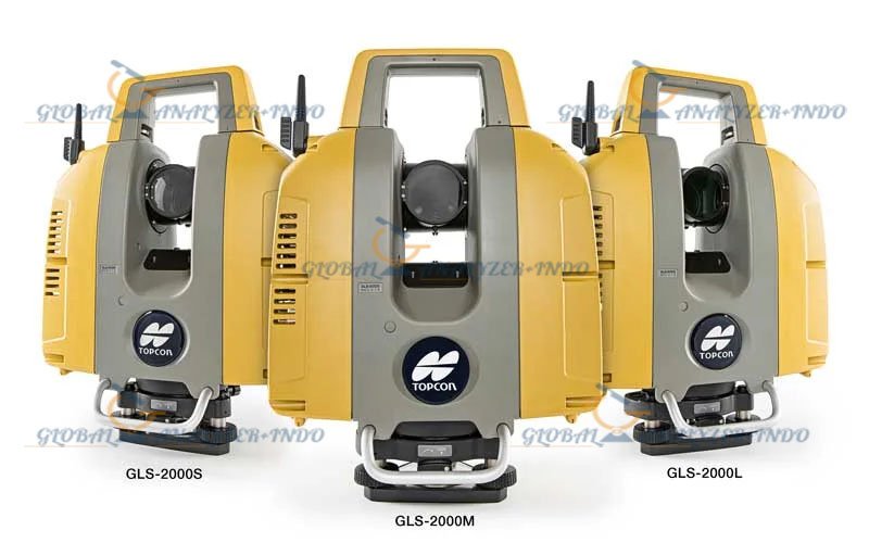
Topcon GLS-2000 Specifications
Here’s a detailed breakdown of the Topcon GLS-2000’s technical specifications to help you understand its full capabilities:
Laser and Measurement Specifications
-
Maximum Range (at 90% Reflectivity):
-
GLS-2000S: 130 m (High Speed)
-
GLS-2000M: 350 m (Standard)
-
GLS-2000L: 500 m (Standard)
-
-
Distance Accuracy: 3.5 mm (1-150 m), 1 sigma
-
Angle Accuracy: 6 arc-seconds
-
Tilt Sensor: Liquid 2-axis, ±6° range
-
Scan Rate: Up to 120,000 points per second
-
Spot Size: ≤ 4 mm at 20 m (FWHM)
Imaging and Visualization
-
Wide-Angle Camera: 170° diagonal
-
Telephoto Camera: 11.9° H / 8.9° V
-
Field of View: 360° horizontal / 270° vertical
-
Color Digital Imaging: Dual cameras for enhanced point cloud definition
Operational and Environmental Specifications
-
Operating Temperature: 23°F to 113°F (-5°C to 45°C)
-
Storage Temperature: -4°F to 140°F (-20°C to 60°C)
-
Dust and Humidity: IP54-rated for dust and water resistance
-
Weight: 24 lbs (with batteries and tribrach)
Why Choose the Topcon GLS-2000 Laser Scanner?
The Topcon GLS-2000 stands out as a powerful, efficient, and user-friendly laser scanner that ensures high-quality, accurate data for a variety of applications. Here are a few reasons why the GLS-2000 is the right choice for your next project:
Speed and Efficiency
Capture a full 360° scan in under 3 minutes, significantly reducing field time and improving project efficiency. Its high-speed scanning and precise data acquisition make it an ideal tool for professionals in fast-paced environments.
Versatility and Flexibility
With three different models available (S, M, L), the GLS-2000 can meet the needs of various types of projects. Its rugged design ensures it can be used in a wide range of environments, from construction sites to outdoor geospatial mapping.
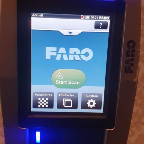
Ease of Use
The Topcon GLS-2000 features an intuitive on-board control system with a 3.5-inch touchscreen, making it easy for users to operate the scanner, even with minimal experience. The device’s compact design ensures portability and ease of setup.
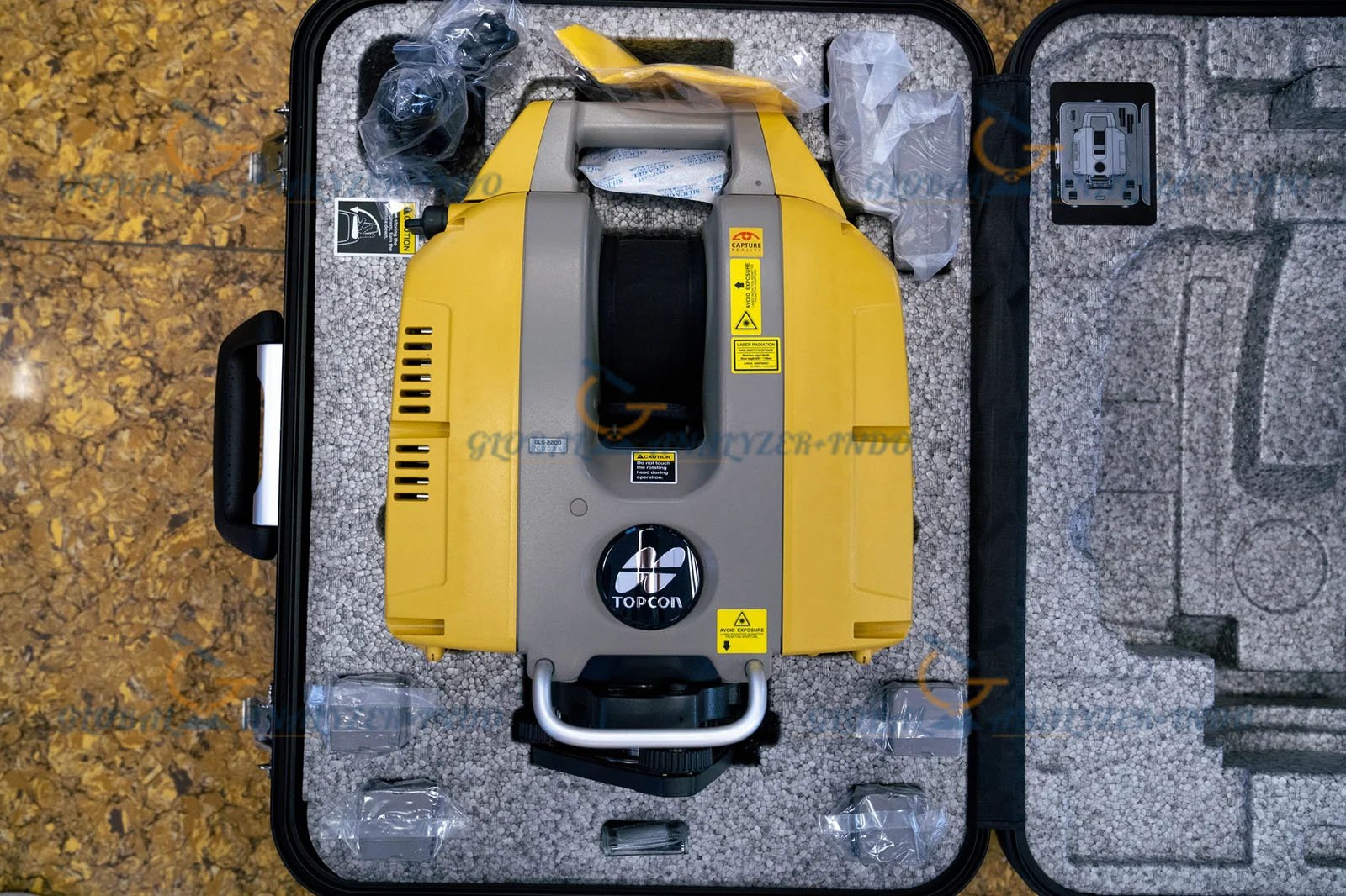
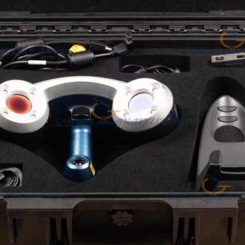
What’s Included in the Topcon GLS-2000 Package?
When you purchase the Topcon GLS-2000, you’ll receive everything you need to get started:
-
Topcon GLS-2000L Laser Scanner
-
4 x Batteries
-
2 x Chargers
-
Tribrach
-
Cleaning Kit and Lens Cover
-
Tooling Kit
-
SDHC Memory Card
-
Tripod
-
Carry Case
-
User’s Manual
-
3-Year Warranty


There are no reviews yet.