
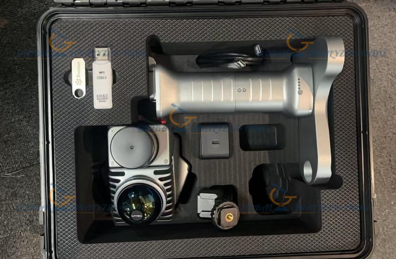
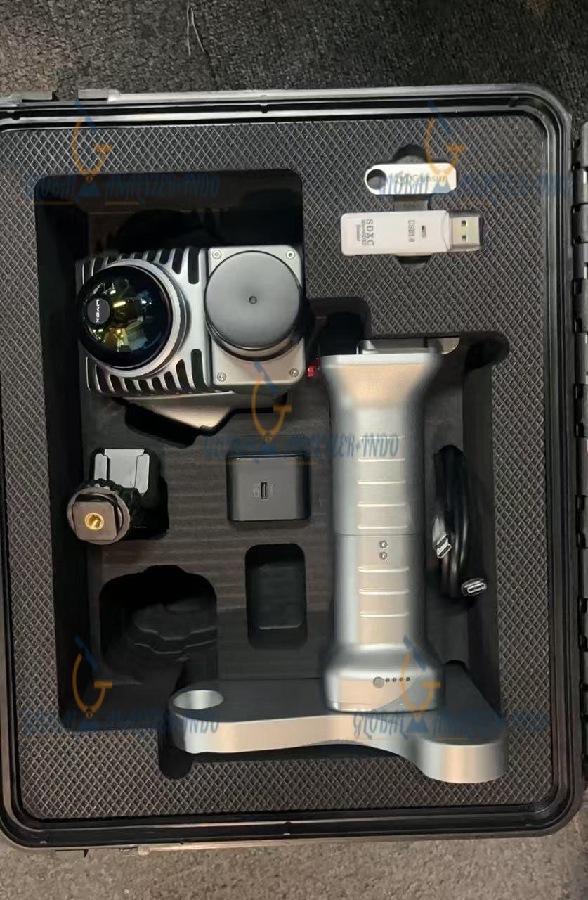
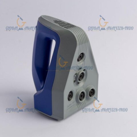
GEOSUN GS-200G Mobile LiDAR System
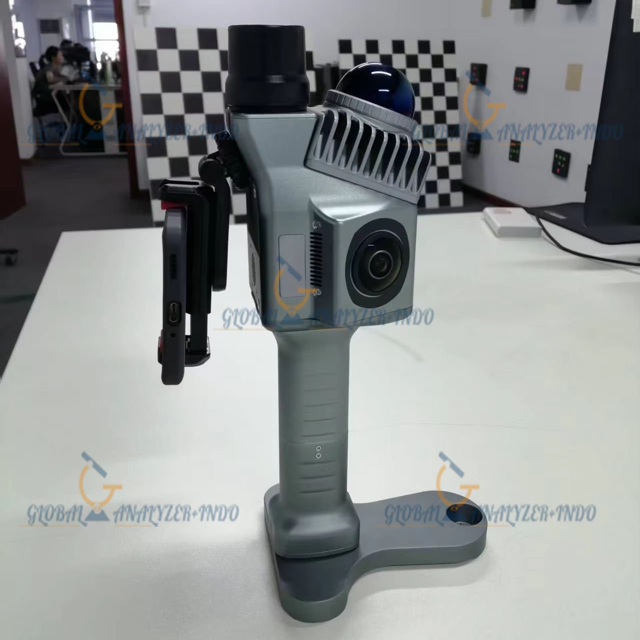
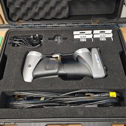
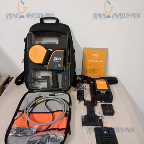
The GEOSUN GS-200G Mobile LiDAR System is a lightweight handheld SLAM-based 3D laser scanning solution designed for high-precision mobile mapping in indoor and outdoor environments. Integrating advanced LiDAR technology, GNSS positioning, IMU sensors, panoramic imaging, and real-time SLAM algorithms, the GS-200G enables rapid point cloud generation for surveying, construction, BIM, mining, infrastructure inspection, forestry, and digital twin applications.
Built for portability and operational efficiency, the GS-200G delivers professional-grade 3D spatial data acquisition while minimizing field setup time and simplifying mapping workflows. Its compact architecture allows operators to scan complex environments quickly without relying on conventional static terrestrial scanning methods.
The system is optimized for professionals requiring accurate geospatial data collection in both GNSS-available and GNSS-denied environments.
Introduction to the GEOSUN GS-200G
Modern geospatial projects demand faster surveying solutions with higher operational flexibility. Traditional tripod laser scanners often require multiple setups, complex registration procedures, and extensive field labor. The GEOSUN GS-200G addresses these challenges through integrated SLAM (Simultaneous Localization and Mapping) technology.
The scanner continuously captures laser measurements while the operator walks through the environment. Real-time trajectory calculation and positioning algorithms allow the system to generate dense 3D point clouds efficiently.
The GS-200G combines:
- Livox Mid-360 LiDAR sensor
- GNSS positioning system
- High-precision IMU
- Panoramic imaging cameras
- SLAM processing engine
- Mobile mapping software
This integration creates a portable all-in-one LiDAR solution for fast field deployment.
Key Features of GEOSUN GS-200G Mobile LiDAR System
Lightweight Portable Design
The GS-200G features an ultra-lightweight handheld structure weighing approximately 1 kg, making it highly portable for extended field operations.
Advantages of Lightweight Design
Reduced Operator Fatigue
The compact body enables long-duration scanning sessions with improved comfort.
Faster Deployment
The scanner can be rapidly deployed without requiring heavy equipment transportation.
Access to Difficult Environments
Ideal for confined spaces, underground tunnels, industrial facilities, forests, and urban corridors.
Advanced SLAM Mapping Technology
The integrated SLAM engine allows real-time positioning and mapping without requiring continuous GNSS signal availability.
SLAM Benefits
GNSS-Denied Environment Capability
The system maintains accurate positioning inside buildings, tunnels, underground structures, and dense urban environments.
Reduced Ground Control Dependency
Fewer control points are required during field operations.
Faster Data Acquisition
Walking-based scanning significantly accelerates project completion.
Integrated GNSS and IMU System
The GS-200G integrates GNSS positioning and IMU trajectory stabilization for improved absolute accuracy and georeferencing capability.
Supported Satellite Constellations
- GPS
- GLONASS
- Galileo
- BeiDou
Positioning Advantages
Enhanced Outdoor Accuracy
GNSS support improves spatial coordinate consistency during large-area mapping.
Trajectory Stabilization
The IMU compensates for operator movement and motion disturbances.
High-Speed Point Cloud Collection
The scanner captures up to 200,000 points per second for detailed 3D reconstruction.
Point Cloud Benefits
- High-density spatial modeling
- Detailed infrastructure capture
- Accurate terrain representation
- Improved BIM documentation
- Enhanced digital twin generation
Dual 20MP Panoramic Cameras
The GS-200G includes dual integrated 20-megapixel panoramic cameras for colorized point cloud generation.
Imaging Capabilities
Colorized Point Clouds
Images synchronize with LiDAR data for realistic visualization.
Improved Inspection Analysis
Color information supports infrastructure assessment and documentation.
Applications of GEOSUN GS-200G
Land Surveying and Topographic Mapping
The GS-200G enables rapid terrain and elevation data collection for engineering and geospatial projects.
Survey Applications
Road Corridor Mapping
Efficient scanning for highways, railways, and transportation infrastructure.
Urban Mapping
Generation of accurate 3D city models and spatial datasets.
Terrain Documentation
Fast digital terrain model acquisition for construction planning.
Building Information Modeling (BIM)
The scanner supports BIM workflows by capturing precise as-built conditions of buildings and industrial facilities.
BIM Use Cases
- Renovation planning
- Structural documentation
- Facility management
- Construction verification
- Clash detection support
Mining and Tunnel Mapping
The SLAM capability allows efficient underground mapping where GNSS signals are unavailable.
Underground Mapping Benefits
Rapid Tunnel Documentation
Operators can scan large tunnel networks quickly.
Enhanced Worker Safety
Reduced time spent in hazardous underground areas.
Geological Monitoring
Detailed spatial data improves inspection and planning.
Infrastructure Inspection
The GS-200G supports inspection workflows for bridges, roads, industrial plants, pipelines, and utilities.
Infrastructure Applications
- Bridge inspection
- Utility corridor documentation
- Industrial asset management
- Pipeline mapping
- Facility digitalization
Forestry and Environmental Monitoring
The mobile LiDAR system can be used for vegetation analysis and environmental surveying.
Forestry Applications
- Biomass estimation
- Tree inventory
- Canopy analysis
- Environmental assessment
- Ecological mapping
Advantages of the GEOSUN GS-200G
Rapid Mobile Mapping
Walking-based scanning workflows dramatically reduce field acquisition time compared to traditional terrestrial laser scanners.
Portable Field Operation
The compact handheld design simplifies transportation and deployment.
Indoor and Outdoor Compatibility
SLAM and GNSS integration support reliable operation across diverse environments.
High-Density 3D Data
The system generates detailed point clouds suitable for engineering-grade analysis.
Reduced Project Costs
Faster scanning workflows reduce labor costs and operational overhead.
Flexible Mounting Platforms
The GS-200G supports handheld, backpack, and custom mounting configurations.
GEOSUN GS-200G Technical Specifications
General Specifications
Product Name
GEOSUN GS-200G Mobile LiDAR System
Mapping Technology
SLAM (Simultaneous Localization and Mapping)
LiDAR Sensor
Livox Mid-360
Positioning System
GNSS + INS + IMU Integrated Positioning
Mapping Modes
- SLAM
- RTK-SLAM
- PPK-SLAM
LiDAR Specifications
Measurement Range
Reflectivity 10%
Up to 40 meters
Reflectivity 80%
Up to 70 meters
Range Accuracy
At 10 m
≤2 cm
At 0.2 m
≤3 cm
Relative Accuracy
≤1 cm
Absolute Accuracy
≤5 cm
Point Acquisition Rate
200,000 points per second
Scanning Mode
Non-repetitive scanning
Horizontal Field of View
360°
Vertical Field of View
-7° to 52°
GNSS and IMU Specifications
GNSS Signal Support
GPS
L1 / L2
GLONASS
L1 / L2
Galileo
E1 / E5b
BeiDou
B1 / B3 / B2a
POS Model
gSpin 210
POS Update Rate
200 Hz
Pitch Accuracy
0.015°
Roll Accuracy
0.015°
Heading Accuracy
0.040°
Positioning Accuracy
Horizontal
±0.02 m
Vertical
±0.03 m
Camera Specifications
Camera Configuration
Dual panoramic cameras
Camera Resolution
2 × 20 MP
Camera Field of View
200°
Image Synchronization
Time-synchronized scanning
Physical Specifications
Weight
1.0 kg
Dimensions
16.5 × 12.0 × 32.4 cm
Housing Material
Industrial-grade aluminum alloy
Operating Temperature
-20°C to +55°C
Storage
128 GB MicroSD card
Power Specifications
Battery Capacity
11600 mAh
Operating Time
Approximately 2 to 2.5 hours
Voltage Range
12V – 20V
System Consumption
<25W
Software and Data Processing
Included Processing Software
PointCloudCreater
Supported Functions
- SLAM trajectory processing
- Point cloud generation
- Real-time visualization
- Colorized point cloud processing
- Georeferencing
- Data export

There are no reviews yet.