
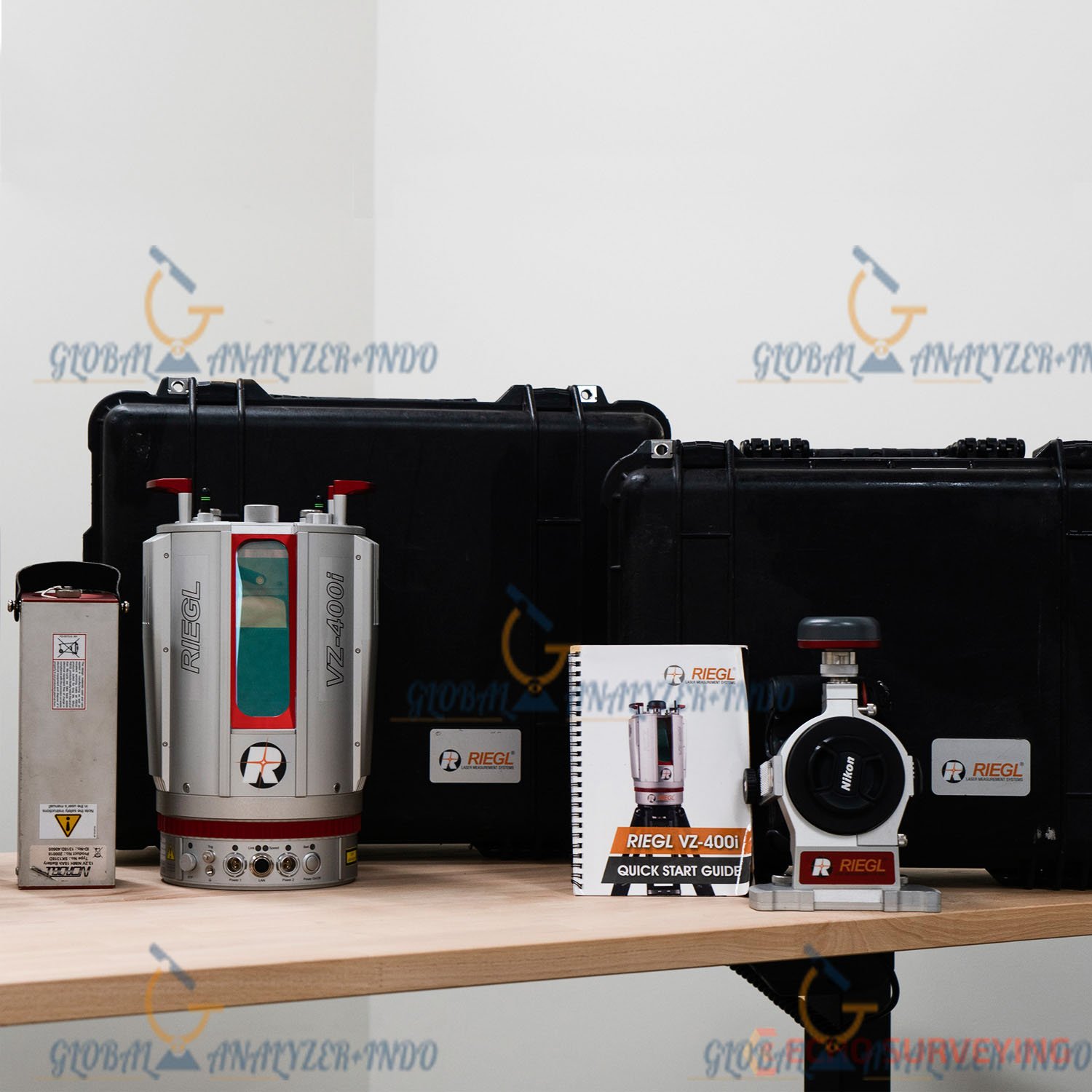
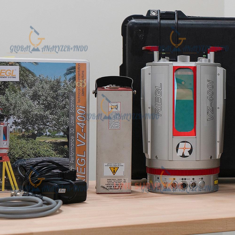
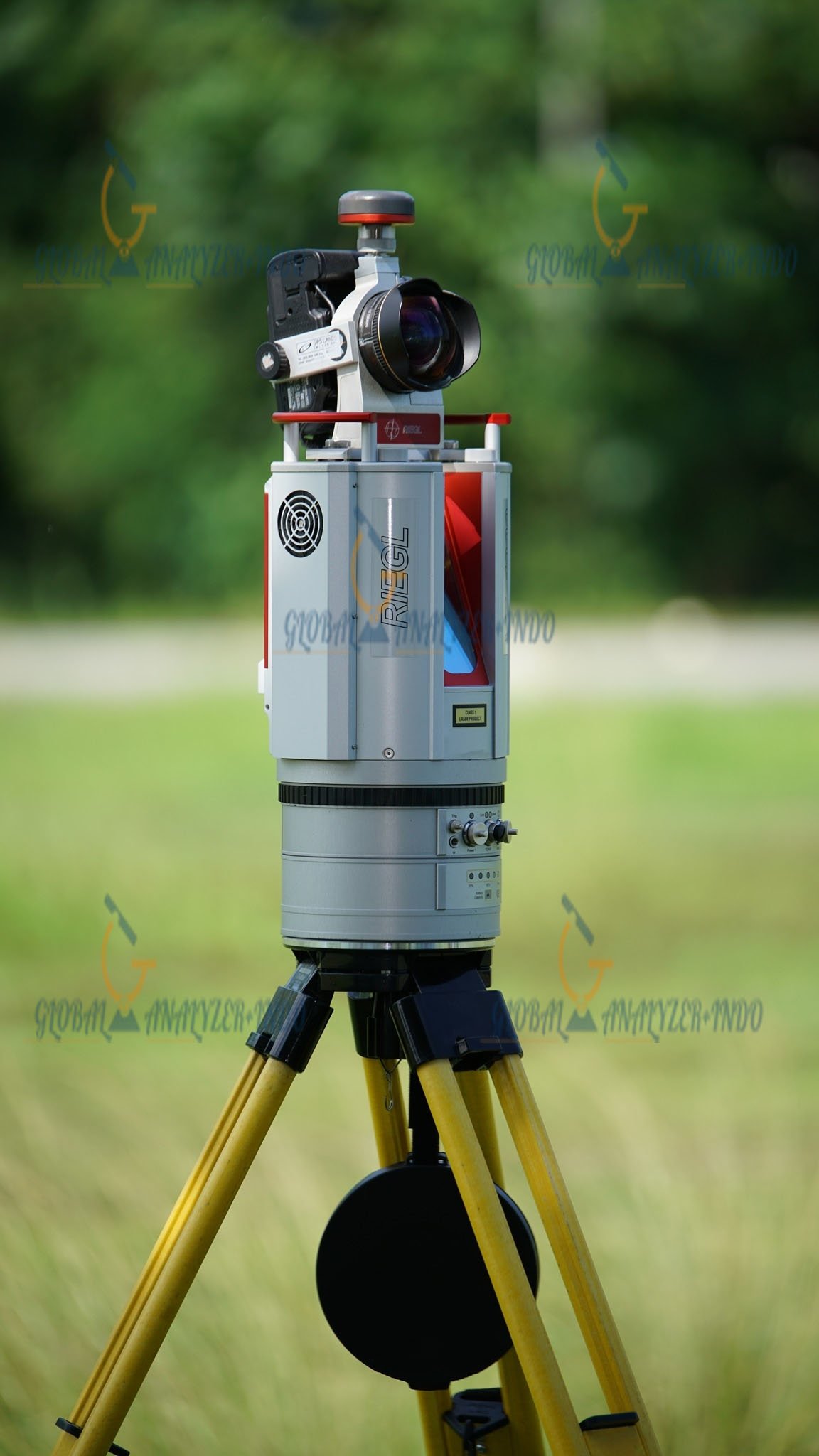
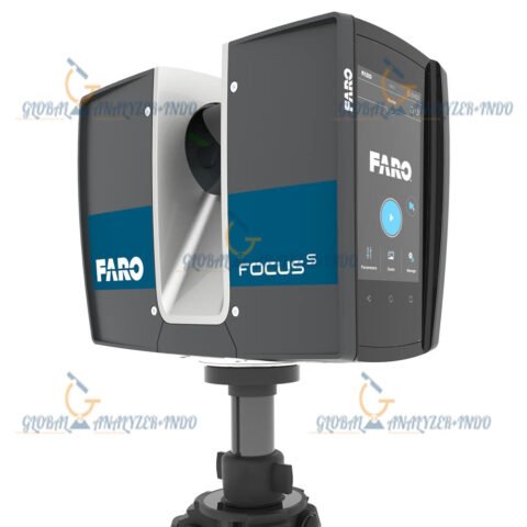
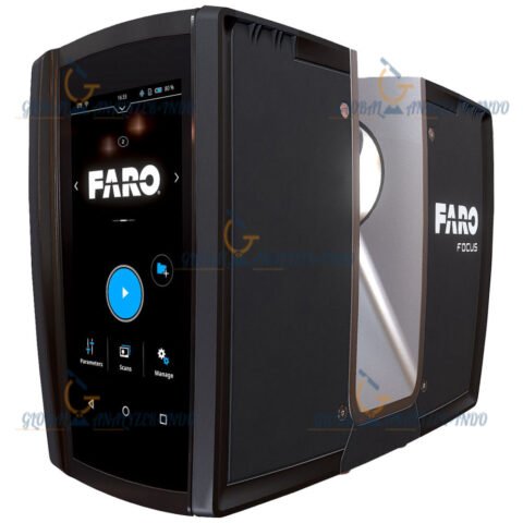
RIEGL VZ-400i 3D LiDAR Scanner
The RIEGL VZ-400i 3D LiDAR Scanner is a high-performance terrestrial laser scanning system engineered for professional-grade 3D mapping, surveying, and geospatial data acquisition. Developed by RIEGL, the VZ-400i combines advanced waveform processing technology, ultra-fast scanning speed, intelligent automation, and precise long-range performance into a compact and rugged field-ready platform.
Designed for applications including topographic surveying, mining, infrastructure inspection, forestry, BIM documentation, industrial plant mapping, and cultural heritage preservation, the RIEGL VZ-400i provides accurate and highly detailed point cloud generation in both indoor and outdoor environments.
The system integrates high-speed laser measurement technology, integrated imaging sensors, GNSS capabilities, inertial navigation support, and wireless communication for streamlined reality capture workflows.
Why Choose the RIEGL VZ-400i 3D LiDAR Scanner
Exceptional Survey-Grade Accuracy
The RIEGL VZ-400i delivers highly accurate 3D measurements suitable for demanding engineering and geospatial applications.
Accuracy Advantages
Precise Long-Range Measurements
Captures reliable data at extended distances with minimal noise.
High Point Density
Produces dense point clouds for detailed modeling and analysis.
Stable Georeferencing
Supports accurate positioning using integrated GNSS and IMU systems.
Ultra-Fast Data Acquisition
The scanner is optimized for high-productivity field operations.
Productivity Benefits
Rapid Scan Completion
Reduces field time significantly compared to conventional survey workflows.
High Measurement Throughput
Captures millions of points efficiently during operation.
Automated Scanning Processes
Simplifies setup and minimizes operator intervention.
Advanced RIEGL Waveform-LiDAR Technology
Waveform Processing Engine
The RIEGL VZ-400i utilizes advanced waveform-LiDAR processing technology for superior target detection and measurement reliability.
Core Technology Features
Multiple Target Capability
Detects multiple returns from vegetation, structures, and complex surfaces.
Echo Digitization
Improves measurement precision in challenging environments.
High Signal Sensitivity
Enhances scanning performance on low-reflectivity surfaces.
Reduced Noise Generation
Produces cleaner point cloud datasets for post-processing.
Main Features of the RIEGL VZ-400i 3D LiDAR Scanner
High-Speed Terrestrial Laser Scanning
The VZ-400i is engineered for rapid high-resolution scanning.
Key Capabilities
Fast Scan Rates
Supports extremely high measurement acquisition speeds.
Full-Dome Scanning
Captures comprehensive environmental coverage.
Real-Time Data Visualization
Enables immediate quality verification in the field.
Integrated Imaging System
The scanner includes advanced imaging functions for realistic project visualization.
Imaging Features
High-Resolution Digital Camera
Captures detailed imagery for scan colorization.
Panoramic Imaging Support
Produces immersive visual documentation.
Colorized Point Clouds
Enhances visualization and analysis workflows.
Intelligent Automation Functions
The RIEGL VZ-400i reduces manual workflow complexity through automation.
Smart Automation Features
Automatic Scan Registration
Improves efficiency during multi-scan projects.
Integrated Positioning Sensors
Supports automated orientation and alignment.
Remote Device Control
Enables wireless scanner operation.
Applications
Topographic Surveying
Surveyors use the VZ-400i for detailed terrain mapping and geospatial data collection.
Common Survey Applications
Terrain Modeling
Generate accurate digital elevation models.
Corridor Mapping
Capture roads, railways, and utility networks.
Boundary Documentation
Support land development and cadastral workflows.
Mining and Quarry Operations
The scanner performs exceptionally well in mining environments.
Mining Applications
Stockpile Volume Calculation
Measure material quantities accurately.
Pit and Tunnel Mapping
Capture underground and surface mine structures.
Slope Stability Monitoring
Analyze terrain deformation and safety conditions.
Industrial Plant Documentation
Industrial facilities require accurate digital representations for maintenance and modernization.
Industrial Workflows
Plant As-Built Documentation
Digitize industrial environments rapidly.
Pipe Rack Modeling
Capture detailed piping layouts.
Maintenance Planning
Improve shutdown preparation and asset management.
Architecture, Engineering, and Construction
The VZ-400i supports BIM and construction verification workflows.
Construction Applications
BIM Data Acquisition
Generate accurate point cloud references.
Construction Progress Monitoring
Track project development over time.
Structural Inspection
Analyze building geometry and integrity.
Forestry and Environmental Mapping
The scanner can capture vegetation structures with multiple target detection capability.
Forestry Uses
Biomass Analysis
Measure forest density and canopy structure.
Vegetation Mapping
Create detailed ecological models.
Environmental Monitoring
Support conservation and land management projects.
General Specifications
Device Type
Professional terrestrial 3D LiDAR scanner
Manufacturer
RIEGL Laser Measurement Systems
Scanning Technology
Waveform-LiDAR terrestrial laser scanning
Measurement Principle
Time-of-flight laser ranging
System Operation
Static terrestrial scanning
User Interface
Integrated touchscreen and wireless control
Laser Measurement Specifications
Laser Class
Class 1 eye-safe laser
Wavelength
Near-infrared laser wavelength
Maximum Measurement Range
Up to approximately 800 meters depending on target reflectivity
Minimum Measurement Range
Less than 1 meter
Measurement Rate
Up to several hundred thousand measurements per second
Accuracy
Millimeter-level precision depending on configuration and conditions
Precision
High repeatability for engineering-grade projects
Beam Divergence
Low divergence for detailed long-range scanning
Multiple Target Resolution
Supports multiple returns per pulse
Scanning Specifications
Horizontal Field of View
360°
Vertical Field of View
Wide vertical scanning coverage
Scan Speed
Ultra-fast rotational scanning
Angular Resolution
Configurable high-resolution scanning modes
Point Density
Adjustable based on project requirements
Scan Duration
Optimized for rapid field deployment
Imaging Specifications
Integrated Camera
High-resolution digital imaging camera
Image Capture
Automatic panoramic image generation
Point Cloud Colorization
Supported
HDR Imaging
Available for complex lighting conditions
Positioning and Navigation Specifications
GNSS Support
Integrated GNSS receiver compatibility
IMU Integration
Supports inertial navigation systems
Compass Integration
Electronic compass support
Automatic Orientation
Enhanced field positioning capabilities
Connectivity Specifications
Wireless Connectivity
Wi-Fi support
Ethernet Connectivity
Gigabit Ethernet interface
USB Interfaces
High-speed USB data transfer
Remote Operation
Supported through mobile and desktop devices
Data Storage Specifications
Internal Storage
High-capacity onboard storage
Data Formats
Industry-standard point cloud export formats
Real-Time Data Preview
Supported
Data Compression
Efficient onboard data handling
Environmental Specifications
Operating Temperature
Industrial-grade temperature tolerance
Weather Resistance
Rugged outdoor field design
Dust Protection
Protected against harsh environments
Humidity Resistance
Suitable for challenging field conditions
Power Specifications
Power Supply
Rechargeable battery system
Battery Runtime
Extended field operation capability
External Power Support
Supported
Hot-Swap Battery Capability
Available for uninterrupted scanning
Physical Specifications
Weight
Compact and portable terrestrial scanner design
Housing Material
Industrial-grade rugged enclosure
Mounting Options
Tripod and mobile platform compatibility
Transportability
Designed for rapid field deployment
Software Compatibility and Data Integration
RIEGL Software Ecosystem
The VZ-400i integrates with professional RIEGL processing solutions.
Supported Software Functions
Point Cloud Registration
Align multiple scan positions accurately.
Data Cleaning
Remove noise and optimize datasets.
Feature Extraction
Generate surfaces, contours, and engineering models.
Georeferencing
Integrate coordinate systems and survey control points.

There are no reviews yet.