
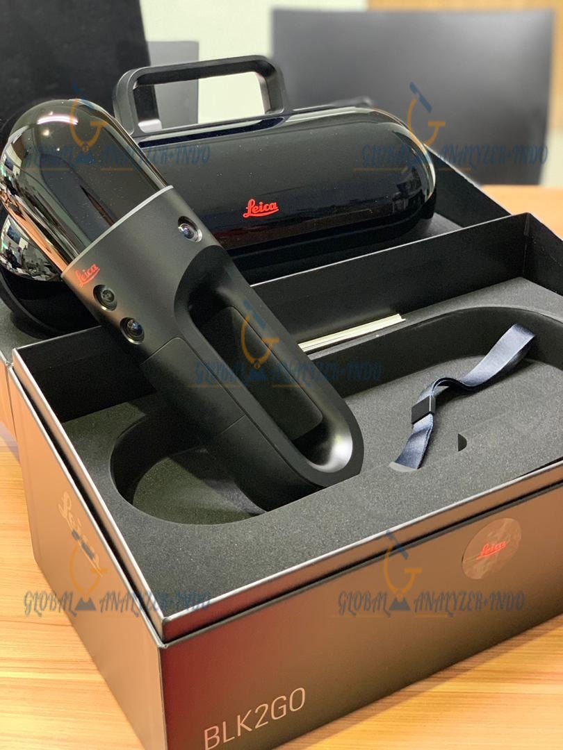

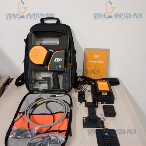
BLK2GO Imaging Laser Scanner
The Leica BLK2GO Imaging Laser Scanner is an advanced handheld mobile mapping system designed for fast, immersive, and highly accurate 3D reality capture. Developed by Leica Geosystems, this intelligent imaging laser scanner enables users to capture complex indoor and outdoor environments while walking naturally through a site.
Unlike traditional static terrestrial laser scanners, the BLK2GO uses SLAM (Simultaneous Localization and Mapping) technology to continuously build 3D point clouds in real time. The compact and lightweight design makes it ideal for professionals in architecture, engineering, construction, industrial inspection, surveying, digital twin creation, and public safety applications.
The BLK2GO integrates LiDAR sensors, visual cameras, thermal imaging, and edge computing into a single portable device. It offers rapid scanning workflows with minimal setup time, making it suitable for environments where speed and mobility are critical.
Why Choose the BLK2GO Imaging Laser Scanner
High-Speed Mobile Scanning
The BLK2GO captures reality while the operator walks through the environment. This eliminates the need for repetitive tripod setups and dramatically reduces field acquisition time.
Key Advantages
Continuous Scanning Workflow
The system continuously scans and records data without interruption.
Real-Time Data Visualization
Operators can monitor scan progress and trajectories directly from a mobile device.
Efficient Large-Area Coverage
Large facilities, buildings, tunnels, factories, and infrastructure projects can be scanned rapidly.
Advanced SLAM-Based Reality Capture Technology
GrandSLAM Technology
The BLK2GO utilizes Leica’s proprietary GrandSLAM technology, combining multiple sensor inputs to create stable and accurate positioning.
Sensor Fusion Components
LiDAR SLAM
Uses laser measurements to map surroundings.
Visual SLAM
Processes camera imagery for enhanced positioning.
IMU Integration
An inertial measurement unit improves motion tracking and scanner orientation.
Edge Computing
Processes large datasets directly within the device for real-time mapping.
Main Features of the BLK2GO Imaging Laser Scanner
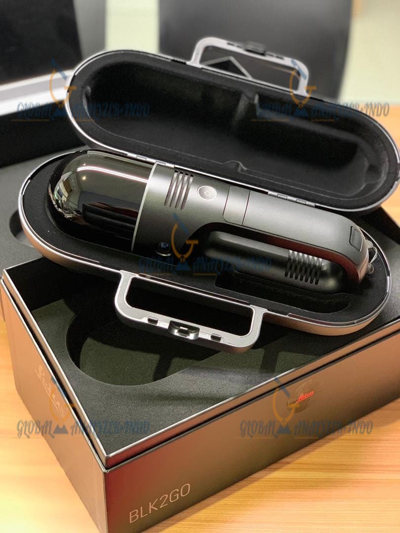
Lightweight Portable Design
The BLK2GO is ergonomically designed for handheld operation in confined or complex environments.
Benefits
Easy One-Hand Operation
The compact form factor supports efficient scanning during movement.
Reduced Operator Fatigue
Balanced weight distribution improves long-duration usability.
Portable Deployment
Fits easily into transportation cases for field operations.
Real-Time Imaging and Point Cloud Generation
The scanner generates live point cloud data while simultaneously capturing panoramic imagery.
Imaging Capabilities
High-Resolution Visual Capture
Integrated cameras produce detailed colorized point clouds.
Thermal Imaging Support
Thermal sensors enable heat anomaly visualization and inspection tasks.
Real-Time Visualization
Users can inspect data immediately after acquisition.
Autonomous Environmental Awareness
The BLK2GO intelligently understands its surroundings during operation.
Smart Navigation Features
Automatic Path Optimization
Enhances tracking stability in dynamic environments.
Motion Detection
Adapts to movement changes and varying scanning speeds.
Environmental Adaptability
Operates effectively in both indoor and outdoor conditions.
BLK2GO Imaging Laser Scanner Applications
Architecture and Building Documentation
Architects and BIM professionals use the BLK2GO for fast as-built documentation and renovation planning.
Typical Tasks
Building Interior Scanning
Capture floor plans and structural layouts.
Historical Preservation
Digitize heritage structures and monuments.
BIM Workflow Integration
Export point cloud data into CAD and BIM software.
Construction and Infrastructure
Construction teams benefit from rapid site documentation and progress monitoring.
Common Uses
Clash Detection
Identify discrepancies before installation.
Progress Tracking
Monitor project development with recurring scans.
Industrial Facilities and Plant Scanning
Industrial environments require fast and safe data capture.
Industrial Applications
Factory Digitization
Create digital twins of manufacturing plants.
Equipment Inspection
Capture piping systems and machinery layouts.
Maintenance Planning
Improve facility management workflows.
Public Safety and Forensics
The BLK2GO supports emergency response and forensic documentation.
Safety Applications
Crime Scene Documentation
Capture accurate spatial evidence quickly.
Disaster Assessment
Map hazardous areas without extensive setup.
Emergency Planning
Create detailed building models for response coordination.
General Specifications
Device Type
Handheld Imaging Laser Scanner
Manufacturer
Leica Geosystems
Scanning Technology
Mobile LiDAR SLAM
Operating Method
Continuous handheld scanning
Point Cloud Generation
Real-time
System Architecture
Integrated multi-sensor fusion
LiDAR Specifications
Laser Scanner Type
Dual-axis LiDAR system
Scanning Range
Up to approximately 25 meters effective range
Scan Rate
Hundreds of thousands of points per second
Field of View
360° horizontal coverage
Point Cloud Accuracy
Survey-grade relative accuracy depending on workflow and environment
SLAM Positioning
Advanced GrandSLAM real-time localization
Imaging System Specifications
Visual Cameras
Integrated panoramic imaging cameras
Thermal Camera
Integrated thermal imaging sensor
Image Resolution
High-resolution immersive imagery
Colorized Point Clouds
Supported
Real-Time Video Feedback
Supported
Navigation and Motion Sensors
IMU
Integrated inertial measurement unit
Motion Tracking
Real-time trajectory stabilization
Sensor Fusion
LiDAR + Visual + IMU integration
Data and Storage Specifications
Internal Processing
Onboard edge computing
Data Transfer
Wireless and USB connectivity
File Export Formats
Industry-standard point cloud formats
Software Compatibility
Compatible with major CAD, BIM, and reality capture platforms
Connectivity Specifications
Wireless Connectivity
Wi-Fi enabled
Mobile Device Support
Tablet and smartphone integration
Remote Monitoring
Supported through companion applications
Battery Specifications
Battery Type
Rechargeable lithium-ion battery
Hot-Swap Capability
Supported
Operating Time
Several hours depending on scanning conditions
Environmental Specifications
Indoor Operation
Supported
Outdoor Operation
Supported
Operating Temperature
Industrial-grade operating tolerance
Rugged Design
Built for field deployment
Software Ecosystem for BLK2GO
Leica BLK Edition Software
The BLK2GO integrates with Leica software solutions for visualization and processing.
Supported Workflows
Point Cloud Registration
Merge and optimize scan datasets.
Digital Twin Creation
Generate immersive spatial environments.
Cloud Collaboration
Share project data remotely.
BIM Integration
Support Autodesk, Revit, Navisworks, and other industry tools.
Benefits of Using the BLK2GO Imaging Laser Scanner
Faster Reality Capture
The mobile scanning workflow significantly reduces field time compared to traditional static scanning systems.
Improved Accessibility
Users can scan narrow corridors, staircases, rooftops, and complex industrial spaces with ease.
Enhanced Data Quality
Integrated imaging and LiDAR technologies create immersive and accurate digital environments.
Reduced Operational Costs
Rapid acquisition reduces labor requirements and project downtime.
Versatile Deployment
Suitable for AEC, industrial, forensic, mining, transportation, and infrastructure sectors.
Industries Using the BLK2GO Imaging Laser Scanner
Architecture and Engineering
Used for design validation, renovation planning, and BIM modeling.
Construction
Supports progress monitoring, QA/QC verification, and digital documentation.
Manufacturing
Improves industrial plant digitization and asset management.
Mining and Tunneling
Captures underground environments efficiently.
Transportation Infrastructure
Used for railways, highways, airports, and utility corridors.
Public Safety
Assists in emergency response mapping and forensic investigations.
Comparison Between BLK2GO and Traditional Laser Scanners
Mobility
Traditional terrestrial scanners require stationary setups, while the BLK2GO enables continuous movement scanning.
Speed
The BLK2GO dramatically reduces acquisition time in large environments.
Ease of Use
Minimal training and setup are required compared to conventional surveying systems.
Data Richness
Combines LiDAR, panoramic imaging, and thermal visualization into a unified dataset.


There are no reviews yet.