
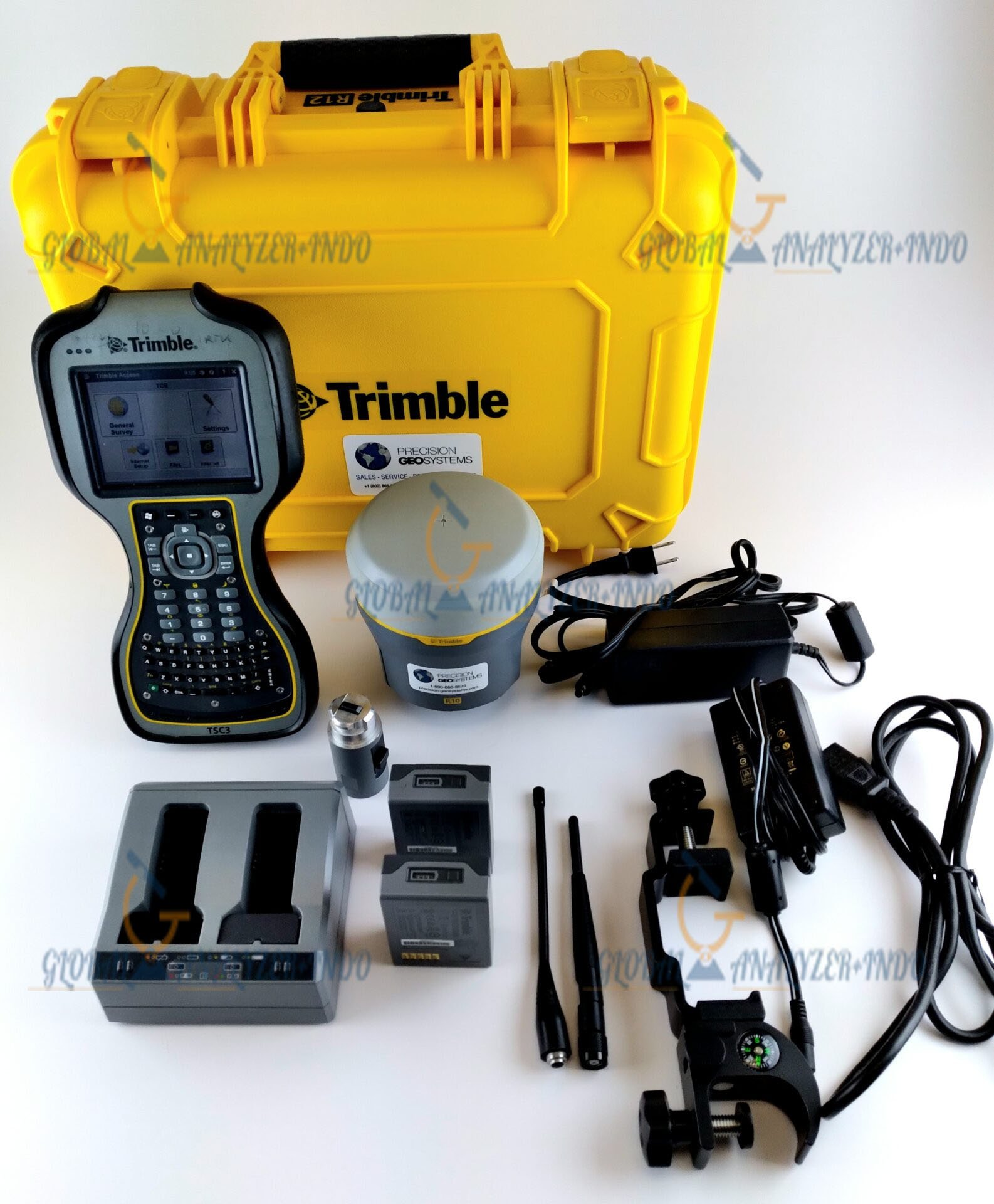
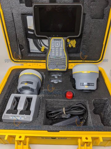
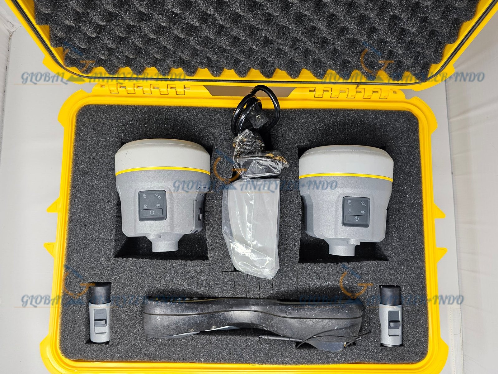
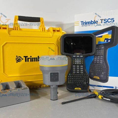
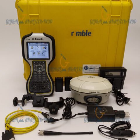
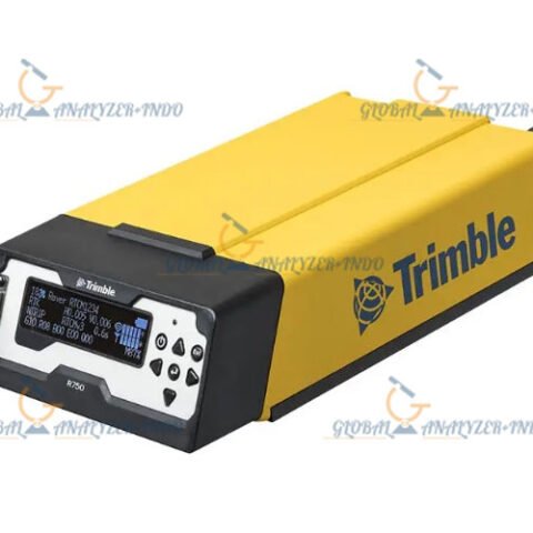
Trimble R10 Model 2 GNSS System: Advanced Positioning for Professional Surveying
The Trimble R10 Model 2 GNSS System is an advanced positioning solution designed for high-accuracy surveying, mapping, and construction applications. By combining innovative GNSS technology with a rugged field-ready design, it enables professionals to collect reliable data even in challenging environments.
What Is the Trimble R10 Model 2 GNSS System?
The Trimble R10 Model 2 is a high-performance GNSS receiver developed for precise positioning tasks. It supports modern satellite constellations and advanced signal processing, allowing surveyors to achieve accurate results in areas with limited satellite visibility. As a result, it is widely used in demanding field conditions.
Core Functions of Trimble R10 Model 2
High-accuracy GNSS positioning
Surveying and mapping data collection
Construction layout and control
Reliable operation in difficult environments
Key Features of Trimble R10 Model 2
Advanced GNSS Signal Tracking
Trimble R10 Model 2 tracks multiple satellite constellations simultaneously. Therefore, it improves positioning reliability and accuracy, even near buildings, trees, or other obstructions.
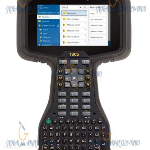
Integrated Design for Field Efficiency
The receiver integrates antenna, GNSS engine, and communications into one compact unit. Consequently, it simplifies setup and reduces equipment complexity in the field.
Rugged and Durable Construction
Designed for harsh outdoor conditions, the Trimble R10 Model 2 withstands dust, moisture, and temperature variations. As a result, it delivers consistent performance on construction sites and remote survey locations.
Technical Capabilities
High-Precision Positioning Performance
The system delivers accurate positioning suitable for professional surveying applications. Moreover, it supports both static and real-time workflows, offering flexibility across different project requirements.
Reliable Communication Options
Trimble R10 Model 2 supports various communication methods for real-time corrections and data transfer. Therefore, users can adapt the system to different network and workflow needs.
Efficient Power Management
The receiver is designed for extended field operation. As a result, survey crews can work longer without frequent interruptions.
Applications of Trimble R10 Model 2 GNSS System
Land Surveying and Mapping
Surveyors use Trimble R10 Model 2 to collect precise spatial data for mapping and boundary surveys. Consequently, it improves accuracy and productivity in field operations.
Construction and Engineering Projects
The system supports construction layout, site control, and as-built documentation. Therefore, it helps ensure accurate positioning throughout the construction lifecycle.
Infrastructure and Utility Surveying
Trimble R10 Model 2 assists with positioning tasks for infrastructure development and utility mapping. Moreover, it performs reliably in complex and congested environments.
Benefits of Using Trimble R10 Model 2
Improved Productivity in the Field
Fast initialization and stable GNSS tracking reduce downtime. As a result, teams can complete surveying tasks more efficiently.
Consistent and Reliable Results
Multi-constellation support ensures dependable positioning data. Therefore, users can trust the accuracy of their measurements.
Long-Term Professional Reliability
Its rugged design and advanced technology provide long-term value. Consequently, it is a strong investment for professional surveying operations.
Why Choose Trimble R10 Model 2 GNSS System?
Designed for Professional Surveyors
Trimble R10 Model 2 meets the needs of surveyors, engineers, and construction professionals. Moreover, it integrates seamlessly into modern GNSS workflows.
Proven Trimble Technology
Built on Trimble’s expertise in geospatial solutions, the system delivers reliable and trusted performance. As a result, it supports critical positioning tasks with confidence.


There are no reviews yet.