
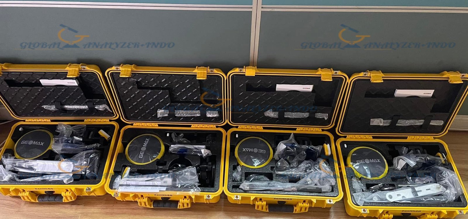
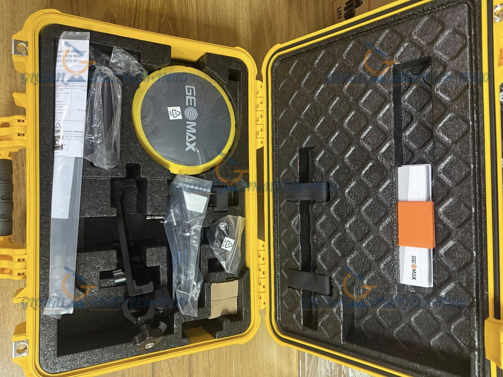
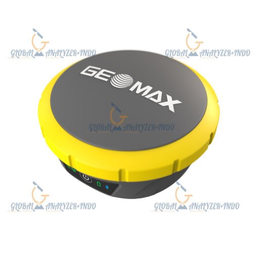
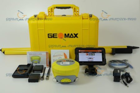
GeoMax Zenith60 GNSS RTK: Advanced Positioning for High-Accuracy Surveying
The GeoMax Zenith60 GNSS RTK is a high-performance GNSS receiver designed to deliver fast, accurate, and reliable positioning for surveying, construction, and geospatial applications. In today’s projects, surveyors require precise real-time data and stable performance. Therefore, the Zenith60 provides an advanced RTK solution that supports efficient workflows and confident decision-making.
Overview of the GeoMax Zenith60 GNSS RTK
The GeoMax Zenith60 is a professional GNSS receiver that supports multi-constellation satellite tracking and real-time kinematic positioning. Moreover, it combines accuracy, durability, and ease of use in a compact design suitable for field operations.
Who Uses the GeoMax Zenith60?
The Zenith60 is widely used by:
Land surveyors and geospatial professionals
Construction and infrastructure engineers
Mapping and GIS specialists
Utility and site management teams
As a result, it fits a broad range of positioning and data collection tasks.
Key Features of GeoMax Zenith60 GNSS RTK
Multi-Constellation GNSS Tracking
The Zenith60 tracks multiple satellite systems simultaneously. Consequently, it delivers stable and accurate positioning even in challenging environments.
High-Accuracy RTK Performance
With real-time kinematic technology, the receiver provides precise positioning results. Therefore, users can achieve reliable accuracy for demanding surveying applications.
Compact and Lightweight Design
The receiver’s compact form makes it easy to transport and set up. As a result, surveyors can work efficiently across different sites.
Technical Capabilities
Fast Initialization and Signal Stability
The Zenith60 achieves quick RTK initialization and maintains signal stability. Consequently, it reduces downtime and improves field productivity.
Flexible Communication Options
The receiver supports multiple communication methods for data transfer. Therefore, it integrates smoothly into various surveying workflows.
Durable Construction for Field Use
GeoMax designed the Zenith60 to withstand harsh conditions. Thus, it performs reliably in dust, moisture, and temperature variations.
Benefits of Using GeoMax Zenith60 GNSS RTK
Improved Survey Efficiency
Fast positioning and stable RTK performance allow teams to complete tasks quickly. As a result, projects stay on schedule.
Reliable Accuracy for Critical Tasks
Consistent positioning accuracy ensures dependable results. Therefore, professionals can trust the data for planning and construction.
Versatility Across Applications
The Zenith60 adapts to different surveying and mapping needs. Consequently, it supports diverse field operations.
Common Applications
Land Surveying and Mapping
Surveyors use the Zenith60 to capture accurate coordinates for boundaries, topography, and control points.
Construction Layout and Control
The receiver supports precise positioning for construction layout and site control activities.
GIS and Data Collection
Mapping professionals rely on the Zenith60 for efficient and accurate GIS data capture.
Why Choose GeoMax Zenith60 GNSS RTK?
The GeoMax Zenith60 combines accuracy, reliability, and user-friendly design. Therefore, it is an excellent choice for professionals who demand high-performance GNSS positioning.
Trusted GeoMax Technology
GeoMax is known for delivering reliable geospatial solutions. Moreover, its products offer strong performance and dependable support.
Designed for Real-World Surveying
The Zenith60 performs consistently in real field conditions. As a result, it supports surveyors working in urban, rural, and remote environments.


There are no reviews yet.