
Leica ScanStation P16 HDS 3D: High-Speed 3D Laser Scanning for Precision Surveying
The Leica ScanStation P16 HDS 3D delivers fast, high-accuracy 3D laser scanning for surveying, engineering, and construction applications. This versatile scanner enables professionals to capture detailed point clouds efficiently, streamline workflows, and achieve reliable measurement results in complex environments.
Overview of Leica ScanStation P16 HDS 3D
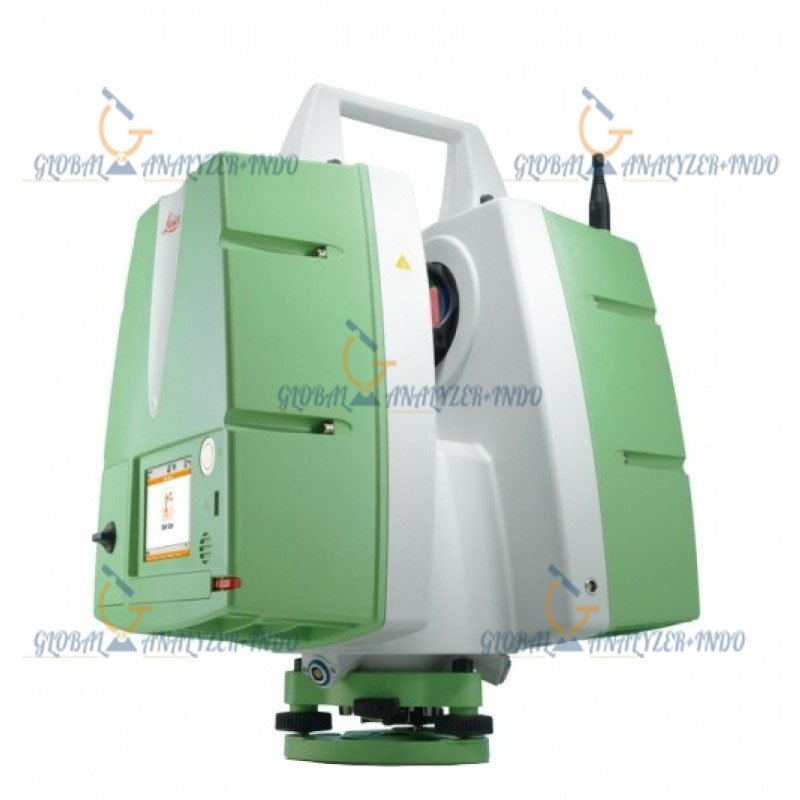
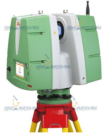
The Leica ScanStation P16 integrates high-speed laser scanning, precise distance measurement, and robust field operation into a single instrument. Surveyors and engineers use this scanner to capture millions of data points, create detailed 3D models, and perform site documentation quickly.
How the 3D Scanner Works
The P16 emits laser pulses across its environment, measuring the distance to objects and generating a dense 3D point cloud. The device combines this data with angular measurements to create accurate 3D representations of sites, buildings, and infrastructure.
Key Features of Leica ScanStation P16 HDS 3D
High-Speed 3D Laser Scanning
The ScanStation P16 scans large areas quickly, capturing millions of points per second. As a result, surveyors can complete complex measurement tasks efficiently.
High Accuracy and Reliability
With precise distance and angular measurement, the P16 ensures reliable data capture. Therefore, professionals can trust it for engineering, construction, and heritage documentation projects.
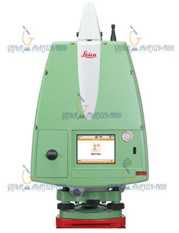
User-Friendly Operation
The intuitive interface allows operators to configure scans, preview data, and manage projects in the field. Consequently, field productivity improves and setup time reduces.
Durable and Field-Ready Design
Designed for outdoor and challenging environments, the ScanStation P16 withstands temperature variations, dust, and vibrations. Moreover, it maintains consistent performance over long-term field operations.
Applications of Leica ScanStation P16 HDS 3D
Building and Construction Projects
Surveyors and engineers use the P16 for building documentation, layout verification, and as-built modeling. As a result, construction teams can ensure accurate execution of design specifications.
Infrastructure and Civil Engineering
The P16 supports road, bridge, and utility projects by providing high-resolution 3D data for analysis and planning. Therefore, engineers can detect deviations and plan interventions efficiently.
Heritage and Industrial Documentation
Additionally, the scanner captures detailed 3D models for heritage sites, factories, and industrial facilities. Consequently, stakeholders can preserve data for maintenance, renovation, or historical records.
Benefits of Using Leica ScanStation P16 HDS 3D
Efficient Data Collection
High-speed scanning reduces the time spent in the field. As a result, surveyors save resources and accelerate project timelines.
Accurate and Detailed Results
The P16 generates dense and reliable point clouds, ensuring precise measurement and documentation for planning and analysis.
Long-Term Investment
With Leica’s proven technology and robust construction, the ScanStation P16 provides long-term value for professionals requiring reliable 3D scanning solutions.
Why Choose Leica ScanStation P16 HDS 3D?
Advanced 3D Laser Scanning Technology
Leica has engineered the P16 for speed, accuracy, and usability. Therefore, professionals gain a versatile tool for diverse surveying and construction applications.
Trusted Leica Quality
The ScanStation P16 reflects Leica’s decades of expertise in precision measurement. As a result, it delivers consistent performance in demanding environments.


There are no reviews yet.