
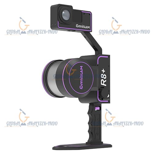
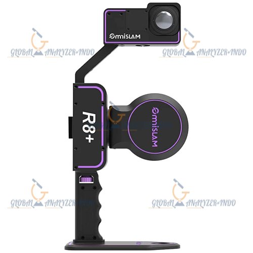
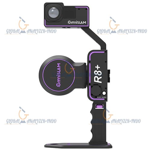
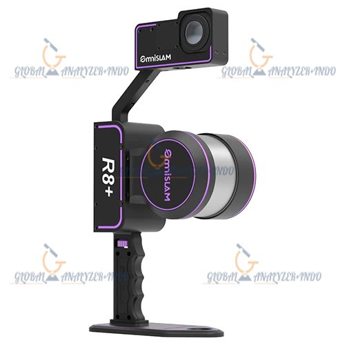
OmniSLAM R8+ Mobile Scanner
The OmniSLAM R8+ Mobile Scanner is an advanced handheld SLAM-based LiDAR mapping system designed for high-speed 3D reality capture, indoor and outdoor surveying, digital twin creation, BIM documentation, infrastructure inspection, and geospatial data acquisition. Engineered with modern Simultaneous Localization and Mapping (SLAM) technology, the R8+ provides accurate point cloud generation without requiring GNSS availability or complex control setups.
Combining lightweight portability, real-time mapping intelligence, and high-density scanning performance, the OmniSLAM R8+ is ideal for surveyors, engineers, architects, construction professionals, mining operators, utility inspectors, and digital mapping specialists.
The system enables fast mobile scanning in complex environments while maintaining reliable positioning and exceptional operational flexibility.
Why Choose the OmniSLAM R8+ Mobile Scanner
High-Speed Mobile Mapping Performance
The OmniSLAM R8+ is designed for rapid reality capture applications where speed, mobility, and accuracy are critical.
Key Advantages
- Real-time SLAM positioning
- Fast 3D point cloud generation
- Portable handheld operation
- Indoor and outdoor scanning capability
- GNSS-denied environment performance
- Lightweight ergonomic design
- High-density LiDAR data acquisition
- Efficient post-processing workflow
Advanced SLAM Technology
Simultaneous Localization and Mapping
The core technology behind the OmniSLAM R8+ is its advanced SLAM engine.
Benefits of SLAM Mapping
- No need for total station control points
- Operates without GPS signals indoors
- Real-time positioning correction
- Reduced survey setup time
- Continuous trajectory calculation
- Improved mapping efficiency
- Stable navigation in complex environments
Ideal SLAM Environments
- Underground tunnels
- Industrial plants
- Warehouses
- Shopping malls
- Airports
- Construction sites
- Heritage buildings
- Dense urban corridors
High-Performance LiDAR Sensor System
Accurate 3D Data Collection
The OmniSLAM R8+ integrates a professional-grade LiDAR sensor capable of capturing dense and highly accurate spatial information.
LiDAR Features
- High-speed laser scanning
- Dense point cloud output
- Long-range measurement capability
- Wide field of view
- Multi-directional scanning coverage
- Real-time environment capture
Scanning Benefits
- Improved spatial accuracy
- Enhanced object detail
- Faster area coverage
- Reduced scanning blind spots
- Reliable structural documentation
Portable and Lightweight Design
Engineered for Mobility
The OmniSLAM R8+ is optimized for handheld and mobile operation.
Portability Advantages
- Easy one-person operation
- Lightweight scanning platform
- Comfortable ergonomic handling
- Reduced operator fatigue
- Quick deployment in the field
- Efficient transportation between sites
The compact design allows users to scan confined and hard-to-access environments efficiently.
Real-Time Point Cloud Visualization
Instant Data Verification
The R8+ supports real-time visualization during scanning operations.
Real-Time Workflow Benefits
- Immediate quality control
- Live trajectory monitoring
- On-site data verification
- Reduced rescanning requirements
- Faster project completion
- Enhanced workflow efficiency
Operators can instantly identify missing coverage areas while still on-site.
Indoor and Outdoor Mapping Capability
Flexible Multi-Environment Operation
The OmniSLAM R8+ performs efficiently across multiple surveying conditions.
Supported Environments
- Indoor facilities
- Outdoor construction zones
- Industrial plants
- Mining environments
- Urban infrastructure
- Forested areas
- Utility corridors
- Historical preservation sites
Environmental Performance Benefits
- Stable navigation
- Reliable mapping continuity
- Consistent data quality
- Enhanced terrain adaptability
High-Density Point Cloud Generation
Detailed 3D Reality Capture
The scanner produces highly detailed point clouds for engineering and digital twin applications.
Point Cloud Advantages
- Accurate object reconstruction
- BIM-ready datasets
- Detailed architectural documentation
- Structural deformation analysis
- Asset management integration
- Engineering inspection support
Integrated Camera System
Enhanced Visual Documentation
Many OmniSLAM R8+ configurations include integrated imaging systems.
Camera Features
- Colorized point cloud generation
- Visual site documentation
- Texture mapping capability
- Improved object identification
- Enhanced inspection reporting
Imaging Applications
- Building documentation
- Facility management
- Construction progress tracking
- Infrastructure inspection
OmniSLAM R8+ Workflow Efficiency
Fast Data Acquisition Process
The system simplifies complex mapping projects.
Efficient Workflow Steps
Step 1 – Device Initialization
Quick startup and calibration process.
Step 2 – Mobile Scanning
Walk naturally through the environment while collecting data.
Step 3 – Real-Time SLAM Processing
The scanner continuously calculates trajectory and spatial positioning.
Step 4 – Point Cloud Export
Export data into industry-standard formats for processing and modeling.
Software Compatibility and Data Integration
Professional Mapping Ecosystem
The OmniSLAM R8+ supports integration with major point cloud and CAD platforms.
Compatible Software Platforms
- Autodesk ReCap
- AutoCAD
- Revit
- Bentley Systems
- CloudCompare
- Leica Cyclone
- FARO Scene
- GIS software platforms
Export Formats
- LAS
- LAZ
- PLY
- XYZ
- E57
- OBJ
OmniSLAM R8+ Applications
Construction and BIM
Used for:
- BIM modeling
- Construction verification
- As-built documentation
- Site progress monitoring
- Clash detection
Architecture and Heritage Preservation
Suitable for:
- Historical building documentation
- Cultural heritage preservation
- Interior architectural scanning
- Renovation planning
Industrial Inspection
Ideal for:
- Factory mapping
- Plant documentation
- Pipe routing inspection
- Equipment positioning analysis
Mining and Tunneling
Used in:
- Underground mapping
- Tunnel inspection
- Mine volume calculations
- Hazard analysis
Public Infrastructure
Supports:
- Railway corridor mapping
- Highway documentation
- Airport infrastructure surveys
- Bridge inspection
General Specifications
System Type
- Handheld Mobile LiDAR Scanner
Mapping Technology
- SLAM-based positioning system
Scanner Configuration
- Integrated LiDAR and IMU system
Operation Mode
- Mobile handheld scanning
LiDAR Specifications
Laser Sensor Type
- High-performance 3D LiDAR sensor
Scanning Range
- Long-range mobile scanning capability
Point Cloud Density
- High-density data acquisition
Field of View
- Wide-angle scanning coverage
Scan Speed
- High-frequency laser measurement
Positioning Specifications
SLAM Technology
- Real-time simultaneous localization and mapping
IMU Integration
- High-precision inertial measurement unit
GNSS Dependency
- Operates in GNSS-denied environments
Camera Specifications
Imaging Capability
- Optional color imaging integration
Point Cloud Colorization
- Supported


There are no reviews yet.