
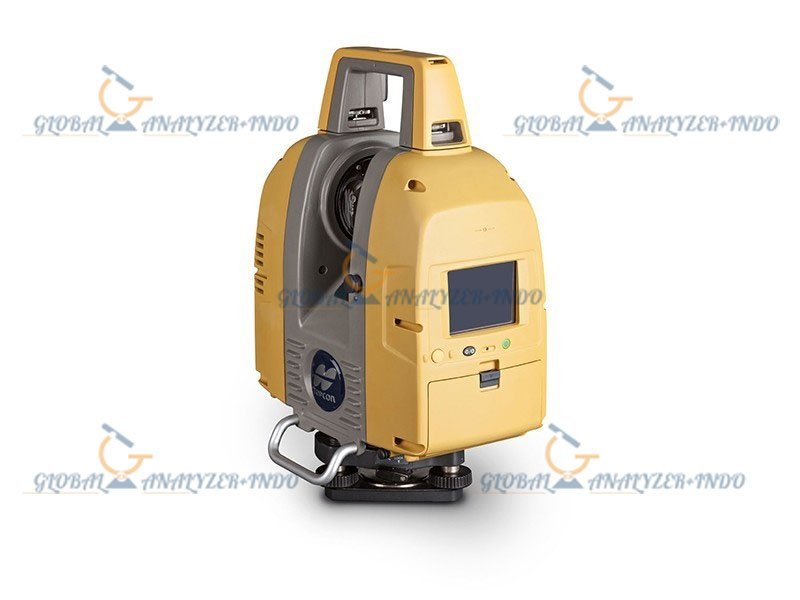
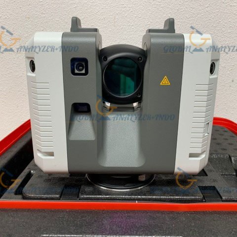
Topcon GLS-2200 3D Laser Scanner: High-Precision Scanning for ICT Construction
The Topcon GLS-2200 is a high-performance 3D laser scanner designed to meet the demands of modern ICT construction and survey applications. Known for its precision, HDR imaging, and user-friendly setup, the GLS-2200 is the ideal tool for obtaining accurate 3D point cloud data in a variety of environments.
Key Features of the Topcon GLS-2200 3D Laser Scanner
The Topcon GLS-2200 is equipped with cutting-edge features that make it a top choice for construction, surveying, and BIM (Building Information Modeling) applications. From precise 3D data capture to high-speed processing, here are the standout features:
Precision 3D Point Cloud Data
The GLS-2200 provides 1mm plane fit accuracy, ensuring high-precision scans that maintain their accuracy even in challenging environments. With the ability to capture 360° prism scans and long-range targets, this scanner excels at delivering clean, detailed data for large-scale projects.
HDR Imaging for Clearer Data
The GLS-2200 features HDR (High Dynamic Range) imaging, which enhances the clarity and quality of the captured point cloud data. This capability is especially useful for rendering 3D models, ensuring more realistic and accurate representations of scanned objects and environments.
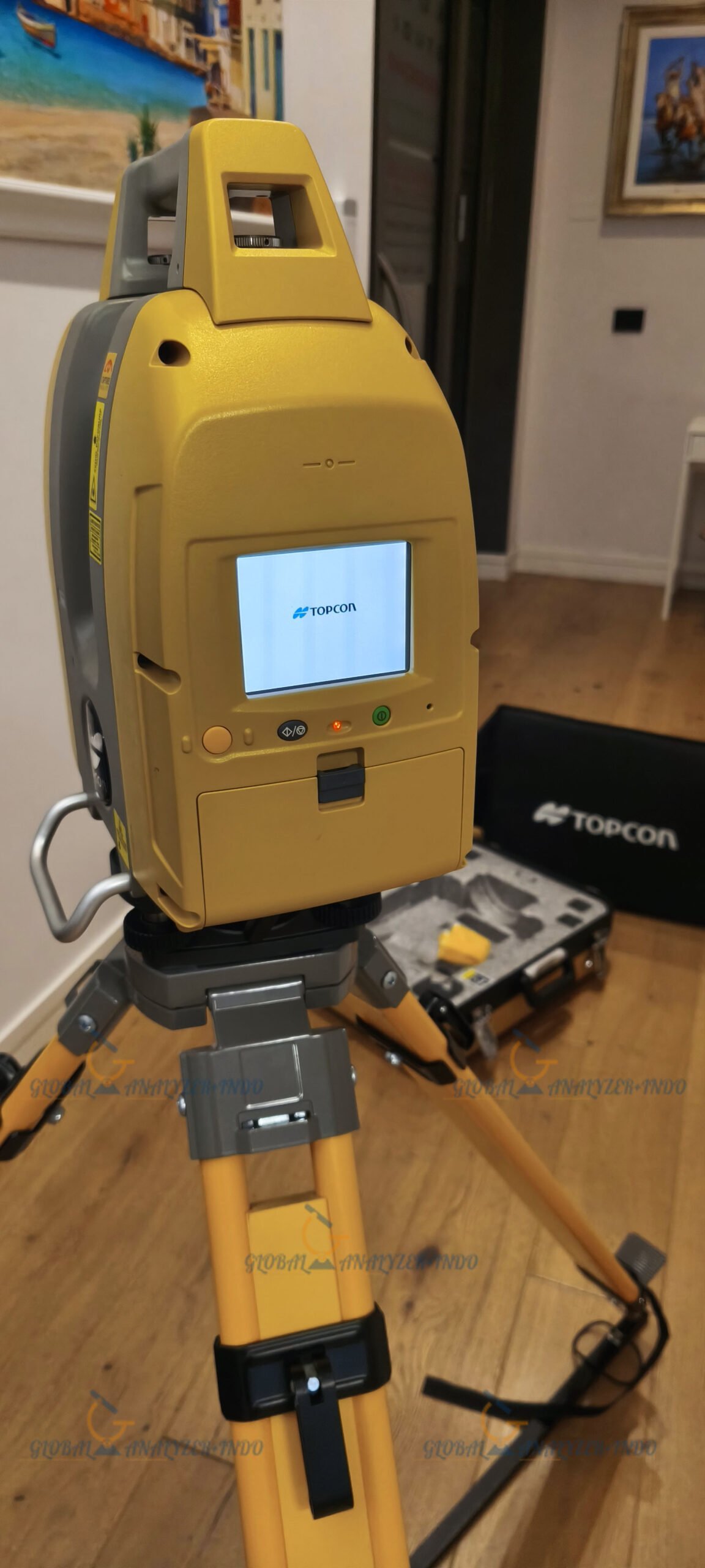
User-Friendly Setup and Workflow
The GLS-2200 integrates a surveyor-style setup, synchronizing the scanner with your design file’s coordinate system. This feature significantly reduces post-processing time, making it easier and quicker to incorporate scanned data into your workflow. Whether you’re working in construction, urban planning, or civil engineering, the GLS-2200 simplifies the scanning process.
Remote Control and Convenient Operation
With its remote control feature, the GLS-2200 allows operators to control the scanner from a distance, streamlining the scanning process and improving overall efficiency. This is particularly valuable in large, complex environments where manual control of the scanner may be difficult or time-consuming.
Applications of the Topcon GLS-2200 Laser Scanner
The Topcon GLS-2200 is designed for a wide range of applications, particularly those requiring high precision and fast data capture. Some of the most common applications include:
ICT Construction and Surveying
For ICT construction, the GLS-2200 is ideal for creating accurate 3D models and digital twins of buildings, roads, and other infrastructure. Its precise data capture and ease of use make it a preferred tool for construction surveyors working in the field.
Archaeology and Historical Preservation
The GLS-2200 is also highly effective for scanning archaeological sites, historical buildings, and other prominent objects. The scanner’s ability to capture fine details at close distances makes it an excellent choice for preserving cultural heritage and documenting historical landmarks.
Disaster Response and Accident Investigation
In situations where speed is critical, such as accident investigations or disaster areas, the GLS-2200 can quickly capture high-precision scans in difficult environments. This feature is especially beneficial for forensic teams and emergency responders who need fast, reliable data.
Urban Planning and BIM
The GLS-2200 integrates seamlessly into BIM workflows. Its ability to capture large areas and provide high-quality 3D data makes it a powerful tool for urban planners and architects working on large-scale projects.
GLS-2200 Scanning Modes
The Topcon GLS-2200 offers several scanning modes tailored to specific needs and environments:
Detail Mode: Ideal for scanning prominent objects, archaeological sites, and historical buildings.
High-Speed Mode: Perfect for accident investigations and disaster areas where speed is essential.
Low Power Mode: Useful in pedestrian-heavy areas or locations with laser limitations.
Standard Mode: Suitable for large structures, residential areas, and volume measurements.
Close Mode: For capturing hard-to-measure objects in close proximity.
Road Mode: Designed for scanning existing asphalt or concrete road surfaces.
High Power Mode: Effective for new asphalt road surfaces or other challenging environments.
Specifications of the Topcon GLS-2200
Below are the key specifications of the Topcon GLS-2200, highlighting its impressive capabilities and versatility:
Laser and Measurement Specifications
Maximum Range: Up to 500 meters (depending on model)
Accuracy: 1mm (plane fit accuracy)
Tilt Sensor: Liquid 2-axis, ±6° range
Scan Rate: Up to 120,000 points per second
Field of View: 360° horizontal / 270° vertical
Imaging and Visualization
HDR Imaging: High-quality image capture for enhanced point cloud rendering
Color Imaging: Provides detailed photographic representation of the scanned environment
Operational and Environmental Specifications
Temperature Range: Operating: 23°F to 113°F (-5°C to 45°C); Storage: -4°F to 140°F (-20°C to 60°C)
Dust and Humidity Rating: IP54 (dust and water-resistant)
Weight: 24 lbs (with batteries and tribrach)
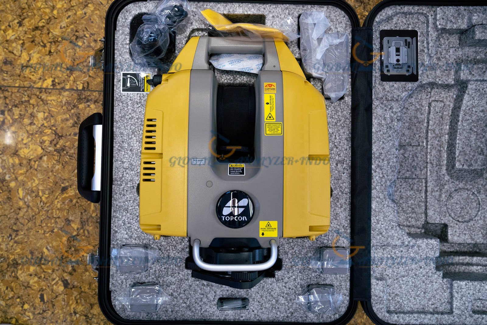
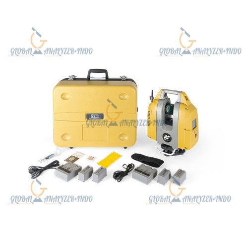
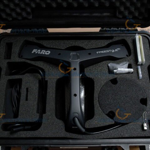
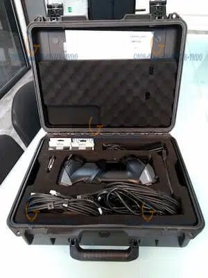
What’s Included in the Topcon GLS-2200 Package?
When you purchase the Topcon GLS-2200, you’ll receive a complete set of accessories and tools to get started right away:
Topcon GLS-2200 Long Range 500m Scanner
MAGNET Collage SCN Scan Kit (Perpetual License)
4 x Batteries (BDC72)
2 x Battery Chargers (CDC77)
Charging Cables (EDC113)
Carrying Case
Silica Gel and Cloth Wipe
SD Card and Case
Tool Kit and Target Sheet
Centering Target
Instruction Manual
Warranty Card (3 Years)


There are no reviews yet.